Stage One of Project Future Proof has reached another milestone, with the concreting of the floodwalls to begin early next month.
Project Future Proof is a multi-stage, multi-year project, led by Toi Moana Bay of Plenty Regional Council, in partnership with Whakatāne District Council and Te Rūnanga o Ngāti Awa, to upgrade the flood defences in the Whakatāne CBD so they can continue to reduce the impacts of a serious flood event on the community.
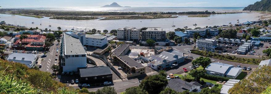
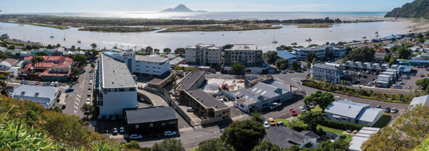
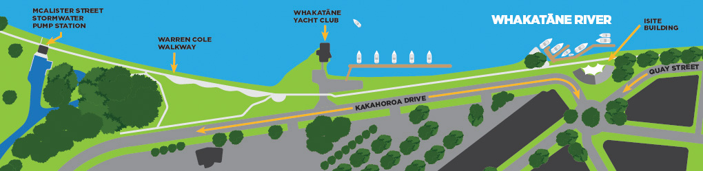
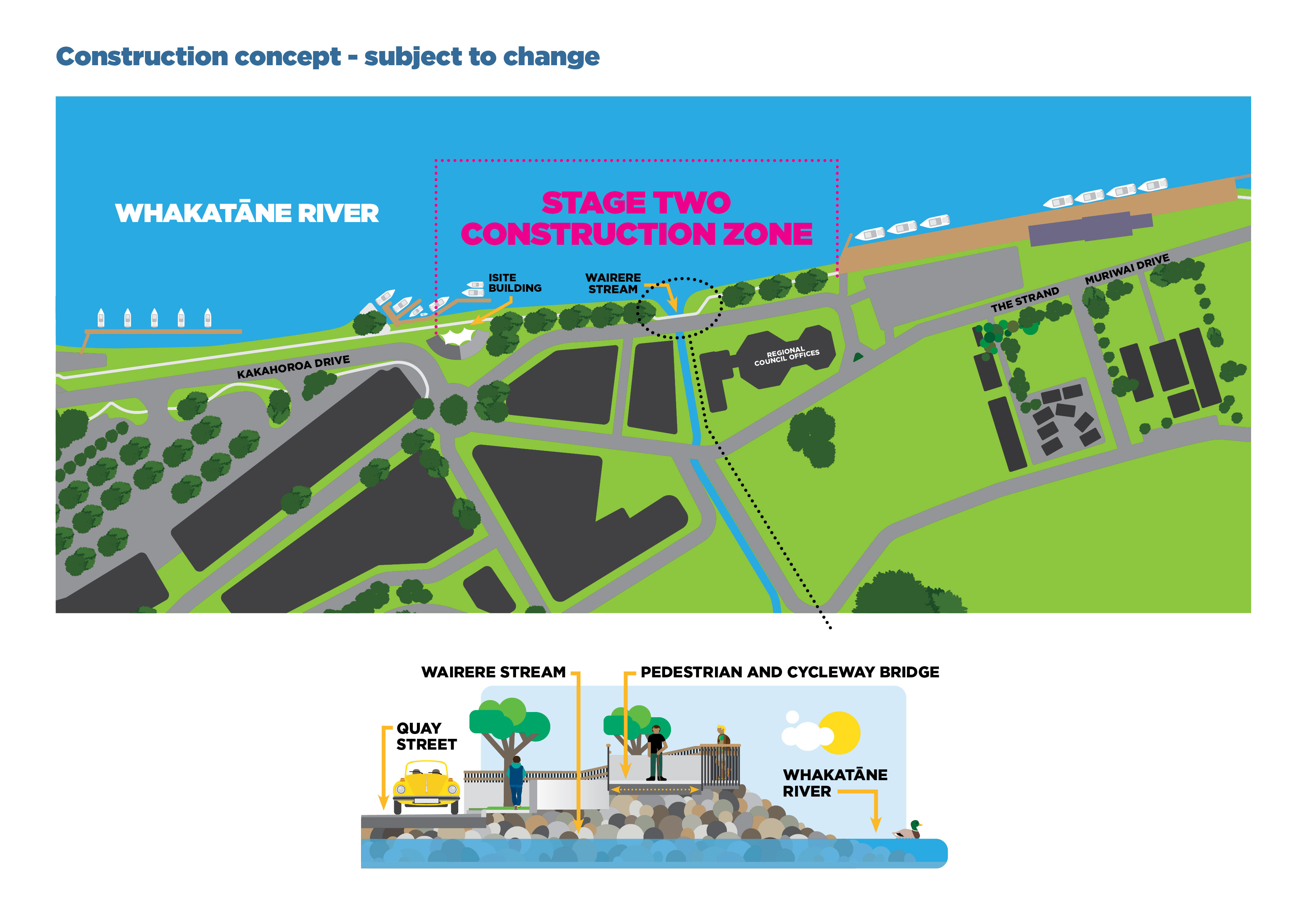
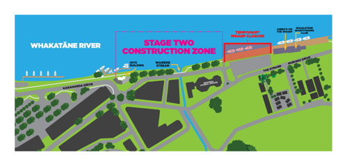
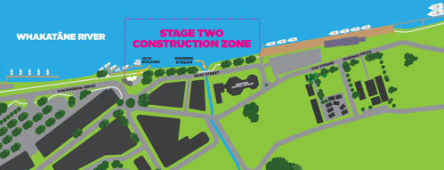
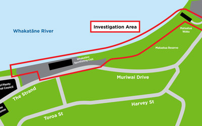
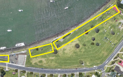
Stage One is focused on improving the stopbanks and floodwalls from McAlister Street Pump Station to the Whakatāne iSite.
Bay of Plenty Regional Council Engineering Manager Mark Townsend says Regional Council has a responsibility to help reduce the impacts of significant flooding on the community.
“We do this through our flood defence infrastructure, such as stopbanks and floodwalls, by creating new flood defences or by upgrading existing ones.
“We need to upgrade our flood defences in the Whakatāne CBD so we can continue to provide flood protection to the town and adapt to meet the challenges of more frequent, more significant weather events that may cause flooding.”
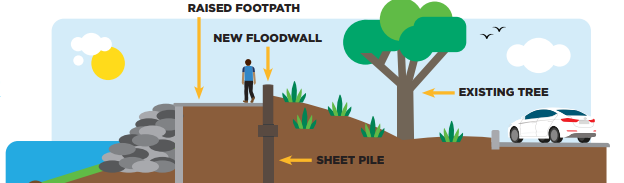
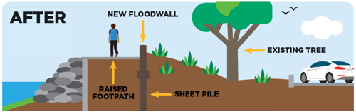
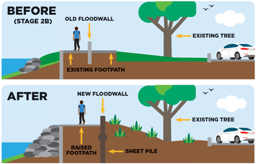
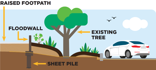
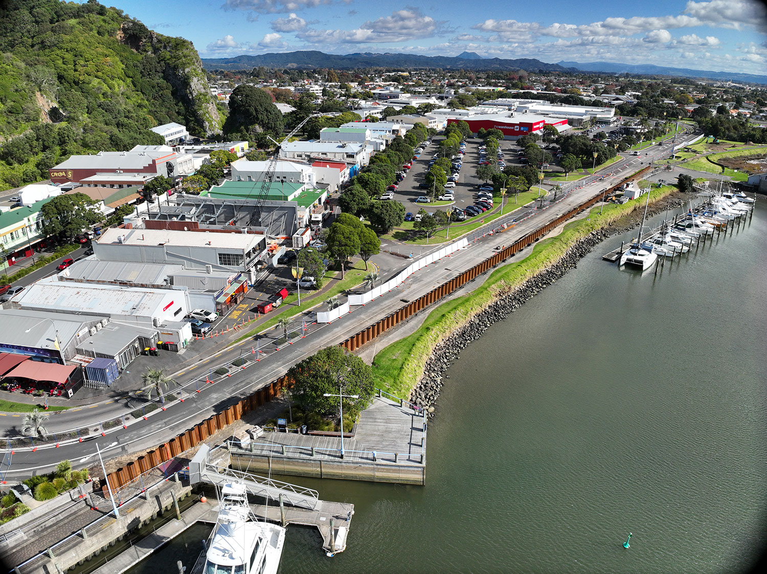
Over the coming months, contractors will work in six metre sections to concrete ‘cap’ the already installed sheet piles between the Yacht Club and the iSite. This process involves using a custom steel mould that is positioned around the sheet piles and filled with concrete, giving the wall its shape. This is the same process that was used on the recently completed College Road floodwalls in Edgecumbe, another Regional Council project.
Additional works in that area include creating stairs and an accessibility ramp for walkway users, and drainage on the roadside of the floodwall.
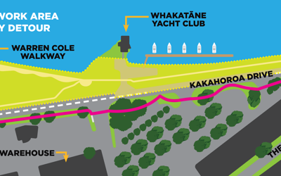
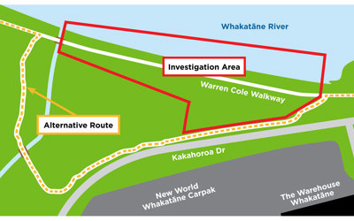
The Warren Cole Walkway will remain closed around the work site, with a detour in place, until the end of July. Following this, there will be a staged re-opening of the walkway.
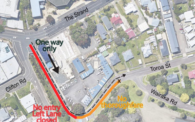
Kakahoroa Drive will stay reduced to one lane from The Warehouse entrance to the roundabout by the iSite, creating a one-way system. Vehicles travelling towards Whakatāne Heads will need to follow a detour through town. This detour will stay in place until the end of July.
We are working with the project contractors on options for a staged re-opening of Kakahoroa Drive from August. Any changes to access for both the walkway and the road will be communicated in due course.
The project is scheduled to wrap-up around October 2024, once both the concrete work and the earthworks between the Yacht Club and the skate park are completed.
Mr Townsend says, “Thank you to the Whakatāne community for their continued patience as we work to complete Stage One as efficiently as possible.”
While works are underway, Regional Council is also working closely with project partners Te Rūnanga o Ngāti Awa and Whakatāne District Council to develop the artistic narrative that will go on the river side of the concrete panels. This artwork is scheduled to be in place by early 2025.
Stage One of Project Future Proof is one of six ‘shovel ready’ projects Regional Council received funding for as part of Central Government’s Crown Infrastructure Funding. The funding covers 75% of the initial project cost. Future stages of Project Future Proof will also receive funding as announced in May’s Budget 2024.