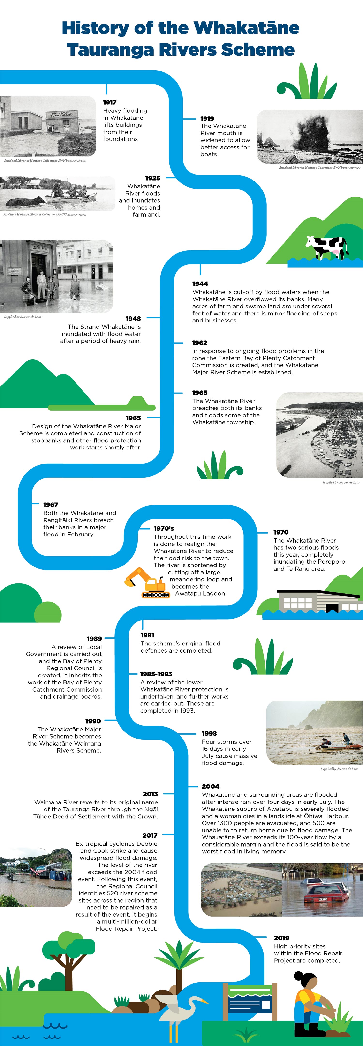
Whakatāne-Tauranga Rivers Scheme
The Whakatāne-Tauranga Rivers Scheme covers the Tauranga River with a 440km2 catchment and the Whakatāne River with a 1100km2 catchment.
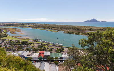
It stretches from Whakatāne town, Tāneatua and Waimana, down to Ruatāhuna and the Huiarau Ranges, and includes the Te Rahu, Waioho and Wairere tributaries.
It is one of five major River Schemes that were established in the 1970s by Regional Council (then known as the Catchment Commission) to effectively manage and maintain the flood defences along the awa, to help protect the lives and livelihoods of the community.
Geoff Stone, Whakatāne-Tauranga Rivers Scheme Area Engineer, tells us more:

This scheme includes:
Bay of Plenty Regional Council owns and manages an array of flood protection and drainage defences across the rohe (such as stopbanks, floodgates, floodwalls etc).
As well as developing new or improved flood defences, our team undertake regular work to test, check, repair and maintain these defences.
We do this to make sure they are in good condition, so that when a flood event occurs, the flood defences will help manage the impacts to the community.


Latest rainfall and river levels
You can also access all rainfall and river level data through our Environmental Data Portal.
All ratepayers across the region contribute to river and drain management. However, if you live within a scheme, you pay an additional targeted rate for the services that you directly benefit from (such as flood protection and drainage).
Find out more information about the River Scheme, Pump & Drainage Scheme targeted rates.
What’s happening in the scheme?
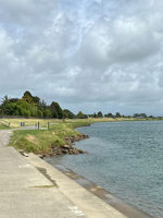
We’re currently doing some stopbank strengthening work along a section of the Whakatāne River Trail. This involves the removal of vegetation and structures which could impact the reliability of the stopbank.
We’re working at ways to protect the community from increased flood risk in the coming decades.

Scheme news and updates
Thanks for your patience Whakatāne as we work to improve the floodwalls and stopbanks in the CBD!
You’ll have noticed that construction is underway from the Whakatāne iSite to McAlister Street Skate Park.
If you’re walking you’ll be redirected to the other side of the road, while traffic headed towards Whakatāne Heads will be guided through town.
BECA, on behalf of Regional Council, will be doing topographical surveying along Quay Street for a week-long period, starting Tuesday 9 January (weather permitting), in preparation for Stage Two of Project Future Proof.
Works on the Whakatāne-Tauranga River Scheme week 8 January to 12 January 2024.
Works on the Whakatāne-Tauranga River Scheme week 28 August to 1 September 2023.
Contractors, on behalf of Regional Council, will be conducting investigative work along Kakahoroa Drive at the end of July for up to five days (weather permitting).
Works on the Whakatāne-Tauranga River Scheme week 24 July to 28 July 2023.
With increased rainfall and weather events impacting the region, Bay of Plenty Regional Council is reminding landowners living near the region’s flood defences to refresh themselves of the rules.
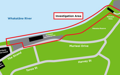
We’ll be out and about doing some surveying work on a section of the Whakatāne River front this week.
This is all part of our investigations for Whakatāne Future Proof which is a programme of work to ensure the stopbanks and floodwalls along the town centre will continue to help protect our community from flooding now, and in the future.
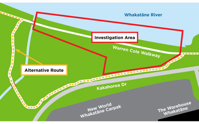
We wanted to give a heads up to users of the Warren Cole River Walk in Whakatāne that there will be some disruption from today.
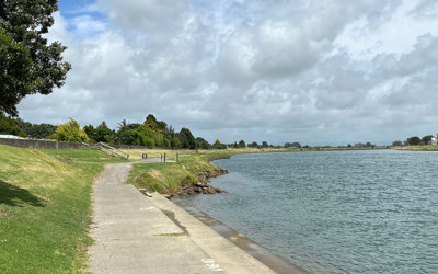
The first stage of work for our Safeguarding our Stopbanks project is underway along the Whakatāne River Trail. This project involves removing encroachments and remediating the entire stopbank over the next three to four years.
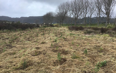
Bay of Plenty Regional Council has been busy planting thousands of tress on the Whakatāne and Tauranga Rivers over the last few months.
Willow Poles have been planted in the upper reaches of the rivers to help stop the banks eroding. Alongside this we have been removing weed and restoring native fish habitat with native plants.

Did you know that Bay of Plenty Regional Council maintain over 350km of stopbanks to help keep you safe?
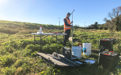
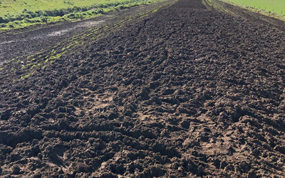
This week we’re doing some soil testing on the stopbank near Natana Place in Whakatāne as part of our efforts to understand more about how our stopbanks are performing.
Our team of engineers are constantly monitoring, maintaining and upgrading our different flood defences including these compacted earth banks built next to rivers to help contain waiter in flooding events.
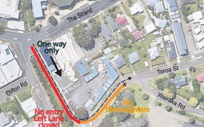
You might see activity around the Wairere Stream in Whakatāne over the next couple of days as part of our work to understand more about the condition of our flood defences.
Access to parts of the stream will be restricted at times and there will be traffic disruption as shown on the map. Please take care in the area, keep speed down and drive safely around the worksite.
Subscribe and stay up to date
Sign up and receive regular emails about what's happening in your River Scheme.
Your River Scheme Advisory Group
Flood protection is an ongoing conversation with the community, to help balance the social, cultural, economic and environmental impacts that flood protection presents.
To help achieve this, we established River Advisory Groups, which are made up of local people from along the river with different interest and involvements in the future of the awa. These locals are here to represent your needs and wants for the awa, which helps advise our teams when it comes to flood projects, maintenance and management.
Find out more the Whakatāne - Tauranga Rivers Scheme Advisory Group.