Skip to main content
Skip to footer
Your council
Council and region
Who we are
What we do
Your councillors
Committees
Maori constituencies
About the region
Regional development
Representation and elections
Council-Controlled organisations
Your district and city council services
Meetings and agendas
Agendas and minutes
Meetings calendar
Meeting process
Live streaming
News and information
Media releases and articles
Public notices
Newsletters
Port of Tauranga shareholding
Plans and policies
Bylaws
Plans
Policies
Long Term Plan
Documents and publications
Reports
Strategies
Publications
Fact sheets
Responses to Official Information Requests
Rates
Rates for 2024-2025
Paying your rates
Your invoice
Direct Debits
Receive your rates invoices by email
Rates remissions
Forms
What your rates pay for
Rates for Whenua Māori
Working with iwi
He Ara Taituarā Fund – Māori Initiatives Fund
Kaupapa Maori
Engaging Maori
Update your contact details
Iwi and Hapū Resource Management Plans
Treaty Toolkit
Statutory acknowledgements
Contact us
Locations and Hours
Request official information
Antenno
Report an issue or ask a question
Careers with us
Rates general query
Procurement
Environment
Maps and data
Maps
Environment data
Monthly rainfall
State of the Environment
Laboratory
Water Ecology Tool
Resource consents
Before you apply
Applying for resource consent
Holding a resource consent
Notified applications, submissions and hearings
Climate change
What we are doing
Our future climate
Adapting to a changing climate
Regional risk assessment
Community-Led Adaptation Funding initiative
Reducing emissions
Tools and resources
What you can do
Fresh water
New national freshwater rules
Updating regional fresh water rules
Engaging with tangata whenua
Rivers, lakes and wetlands
Focus catchments
Water use, takes and metering
Monitoring, science and research
Marae wastewater
Dry weather water management
Co-governance and advisory groups
Flood defences
Kaituna Catchment Control Scheme
Rangitaiki-Tarawera Rivers Scheme
Rangitaiki Drainage Scheme
Whakatane–Tauranga Rivers Scheme
Waioeka-Otara Rivers Scheme
Flood Protection and Drainage Bylaws
Air
Air monitoring
Air quality
Air pollution
Airshed
Mt Maunganui industrial air quality
Mount Maunganui residential air quality
Rotorua air quality project
Spraydrift
Report it
Land
Land management officers
Forestry
Biodiversity
Self-assessment toolkit
River erosion and management guidelines
Farming
Synthetic nitrogen fertiliser cap
Intensive winter grazing
Stock exclusion
Protecting flood defences
Freshwater Farm Plans
Freshwater farm planning and risk identification
Pests
Pest plants
Aquatic pests
Marine pests
Pest animals
Exclusion
Eradication
Progressive containment
Sustained control
Advisory
Pest control guidelines
Geothermal
Surface features
Hazards
Values of geothermal systems
Managing our geothermal systems
Classifying geothermal systems
Geothermal systems
Geothermal glossary and reports
Geothermal plan change
Pollution
Prevention and compliance
Earthworks
Marine pollution
Managing disaster waste
Open burning complaints
Spraydrift complaints
Contaminated land
Coast and ocean
Managing our coast
Aquaculture
Vehicles on beaches
Harbours
Motiti Protection Area
Living in the Bay
Our places
Papamoa Hills Cultural Heritage Regional Park
Onekawa Te Mawhai Regional Park
Marae locations
Boating in the Bay
Being safe
Know the rules
Live cameras and wave buoys
Moorings
Aquatic events and navigation safety licences
Motiti Protection Area
Safe swimming areas
River swimmability
Regional swimmability targets
Natural hazards
Active faults
Coastal hazards
Liquefaction
Tsunami
Landslide
Volcanic hazards
Flooding
Emergencies
Flood Room
Civil Defence Emergency Management
Getting around
Public transport
Accessible transport
Volunteer
Coast Care
Volunteering and Environmental Care Groups
Waste and recycling directory
Teacher resources
Community funding
Environmental Enhancement Fund
He Toka Tū Moana
Te Hāpai Ora
A Helping Hand
Environmental Programme Grants Policy
Community Initiatives Fund
Regional Safety and Rescue Services Fund
School Sustainability and Resilience Fund
He Ara Taituarā Fund – Māori Initiatives Fund
Youth hub
Do it online
Consent forms
Submit an application
Submit annual land use records
Submit a Site Validation Report
Submit a forestry notice
Active Remediation notification form
Apply for a navigation safety licence
Apply for an aquatic event permit
Apply for harbour usage
Find consent documents
Community funding
Regional Infrastructure Fund
Flood Protection and Drainage Bylaw Authority
Request or enquire
Official information request
GIS map request
HAIL request
Flood level letter
Order resources
Make a payment
Pollution Hotline
Report a maritime accident or incident
Make a resource consent submission
Self-certification
Participate
Maps
Environment data
Careers
Contact us
Participate
Maps
Environment data
Careers
Contact us
Menu
Your council
Your council
Overview
Quick Links
News and media releases
Careers with us
Contact us
Council and region
Council and region
Who we are
What we do
Your councillors
Committees
Maori constituencies
About the region
Regional development
Representation and elections
Council-Controlled organisations
Your district and city council services
Meetings and agendas
Meetings and agendas
Agendas and minutes
Meetings calendar
Meeting process
Live streaming
News and information
News and information
Media releases and articles
Public notices
Newsletters
Port of Tauranga shareholding
Plans and policies
Plans and policies
Bylaws
Plans
Policies
Long Term Plan
Documents and publications
Documents and publications
Reports
Strategies
Publications
Fact sheets
Responses to Official Information Requests
Rates
Rates
Rates for 2024-2025
Paying your rates
Your invoice
Direct Debits
Receive your rates invoices by email
Rates remissions
Forms
What your rates pay for
Rates for Whenua Māori
Working with iwi
Working with iwi
He Ara Taituarā Fund – Māori Initiatives Fund
Kaupapa Maori
Engaging Maori
Update your contact details
Iwi and Hapū Resource Management Plans
Treaty Toolkit
Statutory acknowledgements
Contact us
Contact us
Locations and Hours
Request official information
Antenno
Report an issue or ask a question
Careers with us
Rates general query
Procurement
Environment
Environment
Overview
Quick Links
Wastewater
Water take
Contact us
Maps and data
Maps and data
Maps
Environment data
Monthly rainfall
State of the Environment
Laboratory
Water Ecology Tool
Resource consents
Resource consents
Before you apply
Applying for resource consent
Holding a resource consent
Notified applications, submissions and hearings
Climate change
Climate change
What we are doing
Our future climate
Adapting to a changing climate
Regional risk assessment
Community-Led Adaptation Funding initiative
Reducing emissions
Tools and resources
What you can do
Fresh water
Fresh water
New national freshwater rules
Updating regional fresh water rules
Engaging with tangata whenua
Rivers, lakes and wetlands
Focus catchments
Water use, takes and metering
Monitoring, science and research
Marae wastewater
Dry weather water management
Co-governance and advisory groups
Flood defences
Flood defences
Kaituna Catchment Control Scheme
Rangitaiki-Tarawera Rivers Scheme
Rangitaiki Drainage Scheme
Whakatane–Tauranga Rivers Scheme
Waioeka-Otara Rivers Scheme
Flood Protection and Drainage Bylaws
Air
Air
Air monitoring
Air quality
Air pollution
Airshed
Mt Maunganui industrial air quality
Mount Maunganui residential air quality
Rotorua air quality project
Spraydrift
Report it
Land
Land
Land management officers
Forestry
Biodiversity
Self-assessment toolkit
River erosion and management guidelines
Farming
Farming
Synthetic nitrogen fertiliser cap
Intensive winter grazing
Stock exclusion
Protecting flood defences
Freshwater Farm Plans
Freshwater farm planning and risk identification
Pests
Pests
Pest plants
Aquatic pests
Marine pests
Pest animals
Exclusion
Eradication
Progressive containment
Sustained control
Advisory
Pest control guidelines
Geothermal
Geothermal
Surface features
Hazards
Values of geothermal systems
Managing our geothermal systems
Classifying geothermal systems
Geothermal systems
Geothermal glossary and reports
Geothermal plan change
Pollution
Pollution
Prevention and compliance
Earthworks
Marine pollution
Managing disaster waste
Open burning complaints
Spraydrift complaints
Contaminated land
Coast and ocean
Coast and ocean
Managing our coast
Aquaculture
Vehicles on beaches
Harbours
Motiti Protection Area
Living in the Bay
Living in the Bay
Overview
Our places
Our places
Papamoa Hills Cultural Heritage Regional Park
Onekawa Te Mawhai Regional Park
Marae locations
Boating in the Bay
Boating in the Bay
Being safe
Know the rules
Live cameras and wave buoys
Moorings
Aquatic events and navigation safety licences
Motiti Protection Area
Safe swimming areas
Safe swimming areas
River swimmability
Regional swimmability targets
Natural hazards
Natural hazards
Active faults
Coastal hazards
Liquefaction
Tsunami
Landslide
Volcanic hazards
Flooding
Emergencies
Emergencies
Flood Room
Civil Defence Emergency Management
Getting around
Getting around
Public transport
Accessible transport
Volunteer
Volunteer
Coast Care
Volunteering and Environmental Care Groups
Waste and recycling directory
Teacher resources
Community funding
Community funding
Environmental Enhancement Fund
He Toka Tū Moana
Te Hāpai Ora
A Helping Hand
Environmental Programme Grants Policy
Community Initiatives Fund
Regional Safety and Rescue Services Fund
School Sustainability and Resilience Fund
He Ara Taituarā Fund – Māori Initiatives Fund
Youth hub
Do it online
Do it online
Overview
Quick Links
Contact us
Careers with us
Consent forms
Submit an application
Submit an application
Submit annual land use records
Submit a Site Validation Report
Submit a forestry notice
Active Remediation notification form
Apply for a navigation safety licence
Apply for an aquatic event permit
Apply for harbour usage
Find consent documents
Community funding
Regional Infrastructure Fund
Flood Protection and Drainage Bylaw Authority
Request or enquire
Request or enquire
Official information request
GIS map request
HAIL request
Flood level letter
Order resources
Make a payment
Pollution Hotline
Report a maritime accident or incident
Make a resource consent submission
Self-certification
Participate
Maps
Environment data
Careers
Contact us
In this section
Environment
Maps and data
Resource consents
Before you apply
Applying for resource consent
Holding a resource consent
Notified applications, submissions and hearings
Climate change
Flood defences
Air
Land
Farming
Pests
Fresh water
Geothermal
Pollution
Coast and ocean
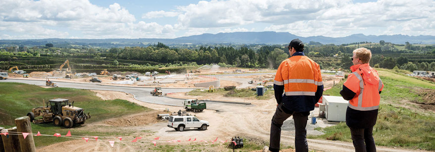
How to find consents across the region
Home
Environment
Resource consents
How to find consents across the region
Environment
Maps and data
Resource consents
Before you apply
Applying for resource consent
Holding a resource consent
Notified applications, submissions and hearings
Climate change
Flood defences
Air
Land
Farming
Pests
Fresh water
Geothermal
Pollution
Coast and ocean