Surface features
Geothermal surface features provide a tangible example of the amazing processes occurring underneath our feet.
Geothermal surface features are an increasingly rare occurrence all over the world but are relatively abundant in parts of the Bay of Plenty. We are fortunate to have about 3000 geothermal surface features in our region with many different feature types.
Many of the internationally significant surface features in the Bay of Plenty region are located within 20 kilometres of Rotorua city centre (which includes those at Whakarewarewa Valley, Kuirau Park, Waimangu Valley and Tikitere). The Rotorua system in particular is world-renowned for its features which include some of New Zealand’s last remaining geysers.
There are also notable surface features at Kawerau, Lake Rotoiti, on Moutohorā Island, Whakaari/White Island and in other locations at a smaller scale.
Feature types
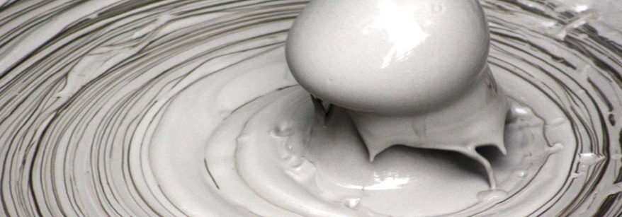
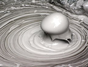
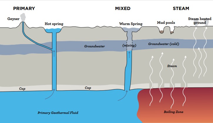
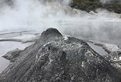
Geothermal surface features in New Zealand are hydrothermal in nature (water or steam dominated) with most groupings having gradational boundaries. The surface features range from those that are in high energy states (fluid or steam), through to over-flowing and non-over-flowing pools (lower energy).
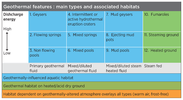
The Bay of Plenty Regional Policy Statement defines four feature categories.
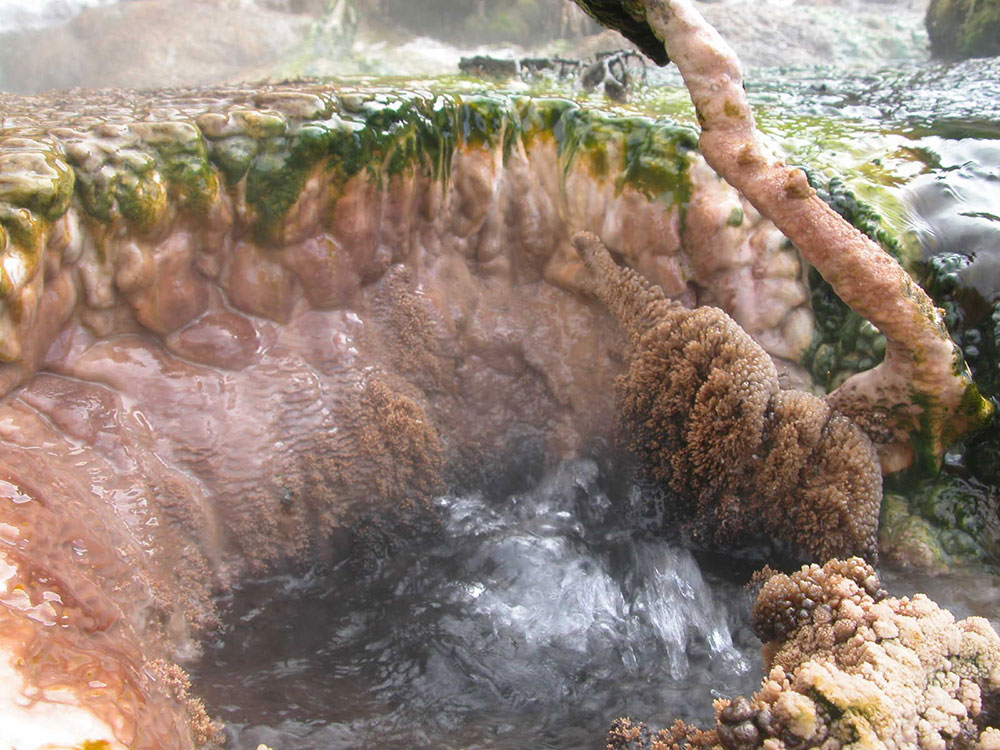
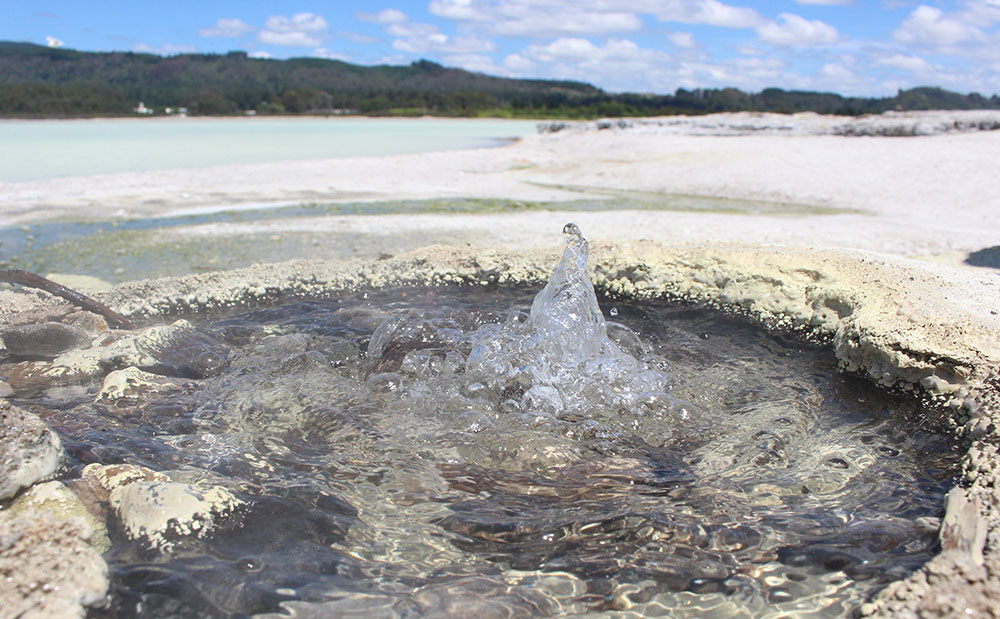
Primary Fluid type, alkaline chloride pools
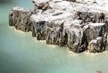
A geothermal spring which maintains a continuous (or regular intermittent) overflow of chloride-enriched primary geothermal water, or, a depression, that naturally receives primary geothermal waters from depth. These are very likely to be sinter-lined and deposit sinter in the overflow channel. The waters in the pools will be clear and hot. The geysers of Rotorua are primary fluid features.
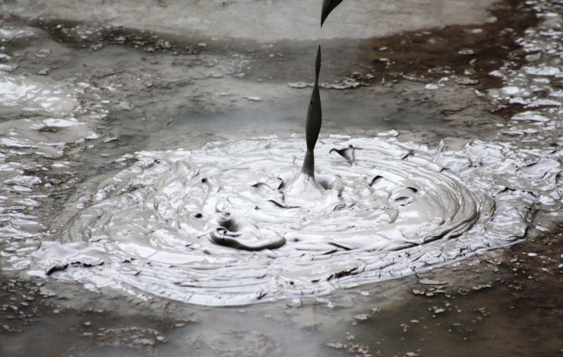
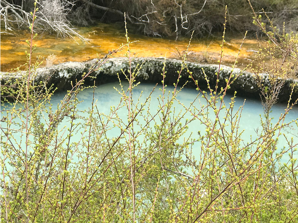
Mixed fluid type, mixed chemical pools
A geothermal spring which has an overflow of mixed geothermal fluid (chloride-enriched water and ground water) or a depression that naturally contains mixed geothermal water. The waters will be coloured and maybe milky.
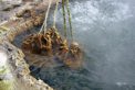
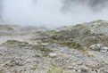
Steam heated type
Steam rising from depth mixes with ground water to make acid water. This results in the grey pools and when soils and clay are included the mud pools form.
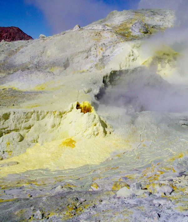
Heated Ground (steam fed)
A ground area that radiates heat from underground geothermal sources, discharging steam, diffusively through surface soils. If the steam flow is strong enough a fumarole may form.
There are also three habitats associated with surface geothermal features, the aquatic one (springs and steams); the terrestrial one (warm and heated ground) and the micro-climate atmosphere. The classification table below describes the physical and associated habitats of these features.
Ecosystems
Geothermally influenced landscapes are dynamic ecosystems that provide unique habitats for threatened species and represent areas of high biodiversity value.
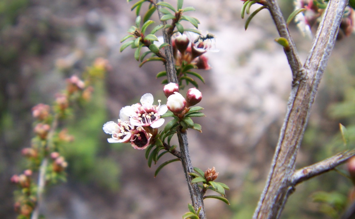
The heat and soil chemistry of geothermally-active soils influence vegetation composition and structure. Geothermal surface features provide microclimates as they make the immediately surrounding area different than the wider environment. This allows plants and animals to develop and interact in unique ways.
There are many unique plants and organisms which have adapted to living in and around geothermal surface features Certain plants such as prostrate kanuka can only be found in geothermal areas and many are listed as threatened or at risk. Some geothermal areas have plant associations that are found nowhere else in the world.
Geothermal habitats are rare ecosystems in New Zealand. Stream sides, heated ground and hydrothermally altered ground are classified as ‘Critically Endangered’ ecosystem types. In our region, we have a quarter of New Zealand’s geothermal vegetation.
Diverse life forms and their genetic material provides many unique opportunities for the future. An example of this is the use of bacteria that thrive at extreme temperatures being used in industrial processes.
For more information, visit the one thousand springs website which is a catalogue of the microbial biodiversity and geochemical information for geothermal features across the Bay of Plenty and the central North Island. This research is being jointly undertaken by GNS Science and the University of Waikato, with funding support from Central Government.
Threats
Because surface features are so rare on a global scale, it is important we protect them for the future.
Many features are fragile and easily damaged. They can change due to natural causes, such as weather patterns, changing climates, earthquake and volcanic activity and also from the impact of humans. During the past 100-plus years, the impact of humans has been much greater than the impact of natural changes (except for eruptions).
Residential, commercial or even public space development can think of geothermal features as messy and unattractive. People “tidy” them, replace the vegetation with more appealing plants, fill them in and use them as dumping areas amongst other things. They can also change due to nearby extraction of energy and fluid. One example of the effects of use on surface features is in Rotorua where population growth, power shortages and the first oil shock directed rapid, unregulated, demand growth in the late 1970s, and led to the decline of surface geothermal activity.
Surface features are vulnerable to direct land use activities such as earthworks, damming and diversion, tracking and vegetation clearance and building and infrastructure development, as well as the indirect impacts on the geothermal landscape and amenity values through intensification and industrialisation. We have in the past lost many features impacting on the values of these special landscapes.
Spatial, regional and district planning has an important role to play in protecting our remaining geothermal features and landscapes.
Mapping and monitoring surface features
Bay of Plenty Regional Council regularly monitors the geothermal systems across the region. This is done mostly through the monitoring of geothermal surface features, the geothermal vegetation and the geothermal aquifer that supports them. We do this to assess the health of the geothermal systems and use the data we collect to make science-based decisions.
Our collective goal is to sustainably manage the geothermal systems, which is a taonga to Māori, and provides an important environment, economic, social and cultural value to the rohe.
All of our data is publicly accessible through the Environmental Data Portal. As indicators of a surface feature’s health, we collect data on the following attributes:
- Size of the feature
- Water temperature and ebullition
- Water level
- Flow
- Clarity and colour
- Odour
- Chemistry.
How we map and monitor
Bay of Plenty Regional Council has prepared Guidelines for Mapping and Monitoring Surface Features with geothermal surface feature experts. This sets out a standard methodology to map and monitor surface features that can be applied throughout Aotearoa New Zealand.
Download a field sheet Geothermal Feature Survey Form from the mapping and monitoring guidelines.