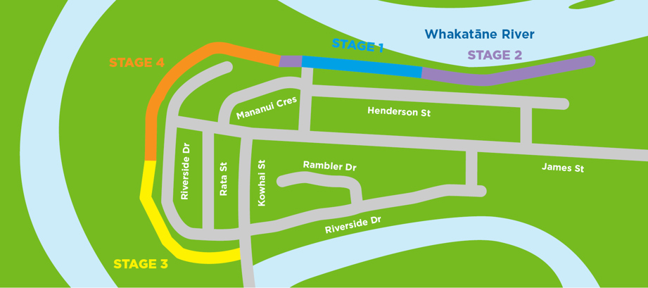
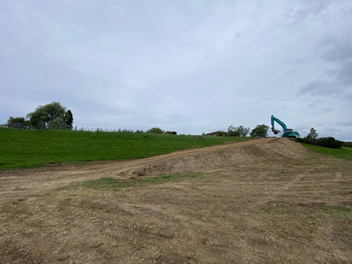
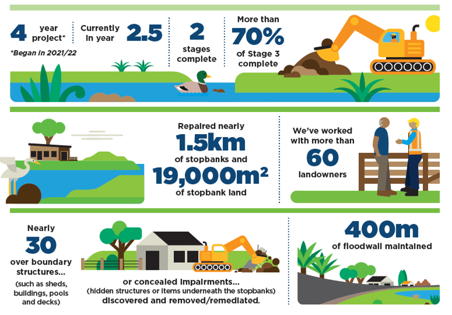
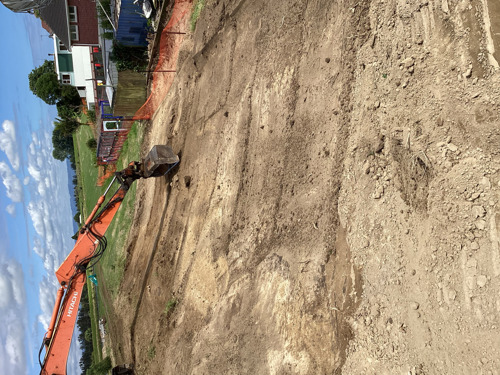
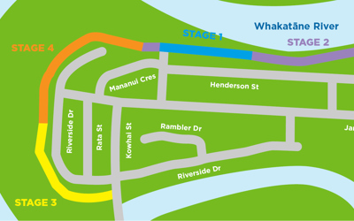
Great news: Stage 3 of the Safeguarding our Stopbanks (SOS) project has been completed by the end of April as planned.
The completion of this stage signals a change in our newsletter frequency. We will publish one around July and one around September, before we resume our regular rotation at the start of the construction season (around October).
Thank you for your part in helping keep the community safe. As always, our team are contactable if you have any questions or concerns on riversanddrains@boprc.govt.nz
Feedback from an SOS resident:
“When we were advised that the stopbank adjacent our house was to be removed from our care it was unsettling to say the least. For 23 years we had mowed and gardened the land as we were led to believe that was our responsibility when we bought the property.
Yes, we had trees and abundant bird life, which we enjoyed. Not easy to see it all go.
We felt we were well informed at every stage, and our concerns were considered, and we were able to reach a compromise.
The contract workers were very good also and considerate of our property.
Now it’s all over and we have landscaped our area inside the fence, it looks great. Still no birds and shade but also no gardening and mowing the stopbank.
On the positive side our view from the second story has improved 100%. Our view of the sunrise and sunsets are better than before.”
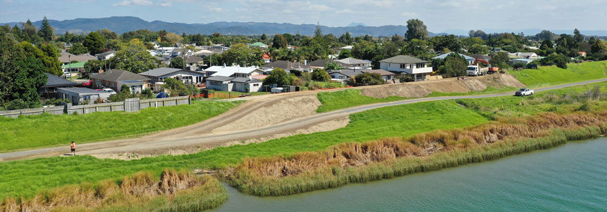
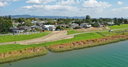
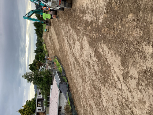
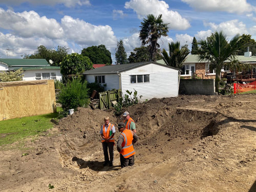
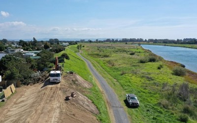
Stage 3: We’re finished!
As you read this, the contractors will have moved out of Stage 3.
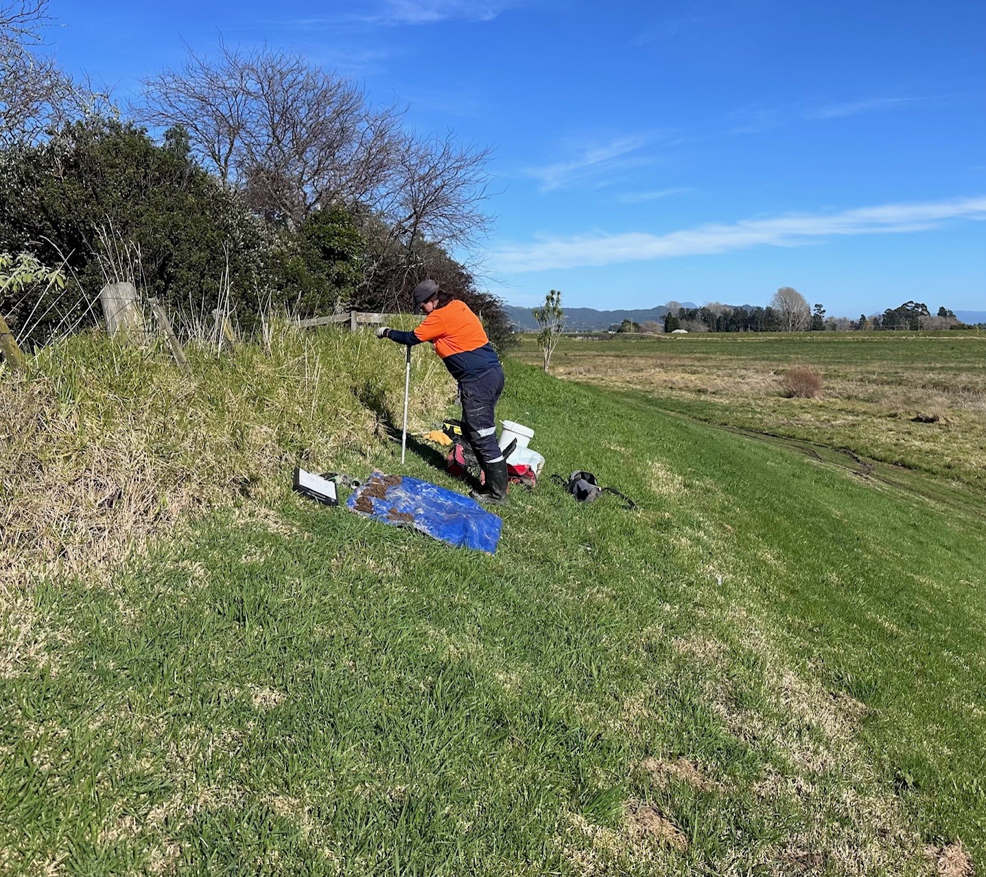
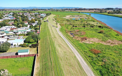
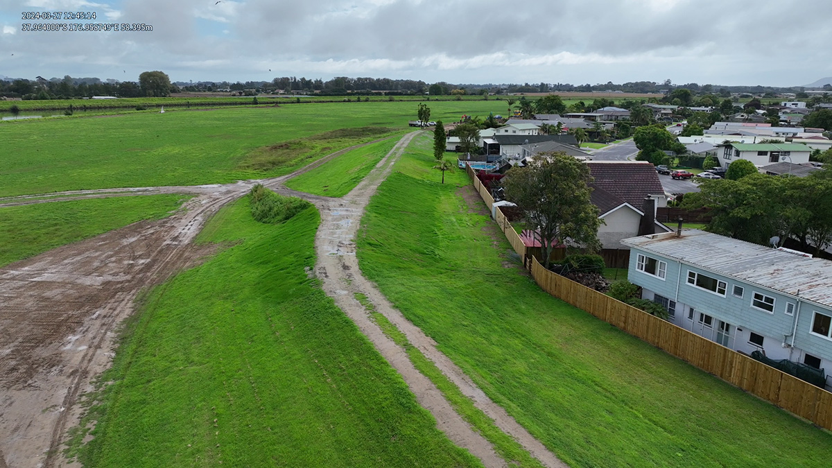
We have hydroseeded the last area of this stage and hope for a little rain to encourage good grass growth. Temporary barriers are installed in some places to restrict movements through the area. Please keep off the grass so good grass cover grows to support the integrity and condition of the stopbank.
As per previous stages, a layer of fine gravel has been placed on the stopbank crest. This helps ensure a compacted surface on the top of the bank for maintenance/monitoring access in the future (such as during heavy rain events). The grass will grow through this material to present a fully grass stopbank.
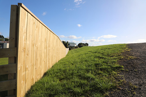
We’re also finalising the fences on Stage 3 properties. If you don’t want one, or can’t decide on a fence now, that’s fine – you have until April 2025 to decide. After this time the Fencing Act applies where costs will be split 50:50 between the landowner and Regional Council.
What happens next?
Long term, once the grass has grown, we will continue our ongoing maintenance programme of mowing the stopbank. We will need to let the grass grow long in the first instance to make sure it is well established. It may look a little longer than usual initially, but rest assured this will be maintained going forward (as ground conditions allow).
Please refrain from throwing any green waste (or any rubbish) onto the stopbank as this will impact the maintenance schedule, and add extra time and cost.
Do you need a Bylaw Authority?
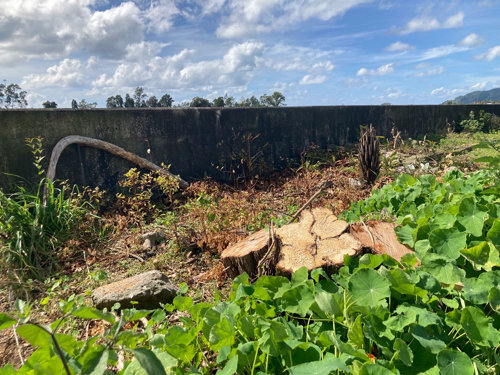
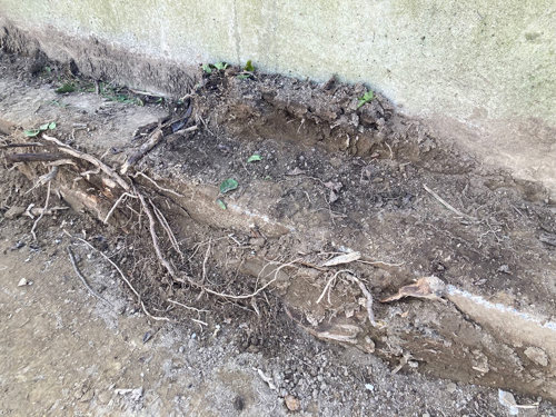
If you are planting within 12m or doing any earthworks within 40m of the toe of the stopbank, you will need a Bylaw Authority beforehand. It’s not about stopping you from doing the works; just making sure any works that are done don’t impact the performance of the stopbank.
Getting a Bylaw Authority is a simple process using an online form. Find out all the details and access the form via our website: boprc.govt.nz/flood-protection-bylaws
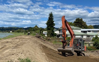
Stage 4: Prep begins
We are in the process of starting conversations with landowners in the Stage 4 area, so you can expect us to contact you in the coming months. Here’s a quick overview of how we link in with property owners to get the work done:
- STEP 1 Information gathering
- STEP 2 Contact with owner
- STEP 3 Onsite visit (June to July)
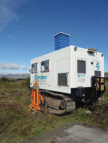
- STEP 4 Plan developed (which may include geotechnical testing and survey work).
- STEP 5 Plan finalised and work starts
- STEP 6 Keeping in touch.
However, if you have questions or want to discuss any over boundary structures, please do not hesitate to contact us before we contact you – we’re always here to help.
While construction isn’t due to start until October, our Rivers and Drainage Area Engineer may do some light site preparation on the river side of the stopbank that will help the contractors for when they come in. This work could include improving access by building up some areas, filling in hollows and dips, or creating access ramps. This work will be dependent on a dry winter and good ground conditions.
Unsure if you have any over boundary structures? Check out the LINZ website to review your property boundary.
Next Reference Group Meeting
The SOS Community Reference Group provides a platform for residents to connect with Regional Council’s project team, have input on how we communicate to residents in the project area, and provide feedback on the process or project to us directly.
As we prepare for Stage 4, we welcome any residents in that area that are keen to join this group. Our next meeting is due to be held on Thursday 23 May. If you’d like to learn about the reference group or get involved, please contact Kirsty Brown, Rivers and Drainage Asset Manager, via email on riversanddrains@boprc.govt.nz
What’s on near you?
River berm management: Would you like to know more?
As discussed in a previous issue of this newsletter, the SOS project has presented an opportunity to think about environmental improvements in the adjacent Whakatāne river berm, to make this a thriving habitat and a more user-friendly space.
This draft river berm management plan is in its infancy and while we have ideas about what we could do, we’re planning to have further discussions with residents.
We’re currently gauging interest in an information session on the topic and would like to hear from you if this is something you’d like to attend.
If so, please email riversanddrains@boprc.govt.nz; Subject line: River Berm Management.
Whakatāne District Council works on Ferry Road
Whakatāne District Council has started construction on the new Ferry Road wastewater pump station and associated pipe network.
The new pump station will include safety enhancements, electrical upgrades, and increased pumping capacity. In conjunction, a 1.3km pipeline, known as a rising main, will be installed to connect the new pump station on Ferry Road to the Hinemoa Street wastewater pump station. This pipeline will facilitate the transportation of sewage to the Whakatāne Wastewater Treatment Plant.
Whakatāne District Council anticipates construction to finish by August 2024. Throughout this period, access to and from the river path via Ferry Road will be temporarily closed for the safety of both workers and pedestrians. Temporary traffic management measures will be implemented in and around the work areas to minimise disruption.
If you have any questions, please contact Whakatāne District Council Project Manager - Three Waters Aimee Thumath on 07 306 0500.
Project Future Proof: FAQs
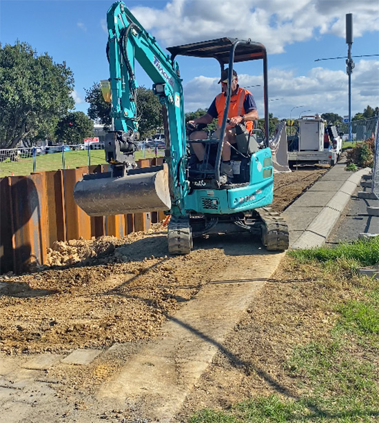
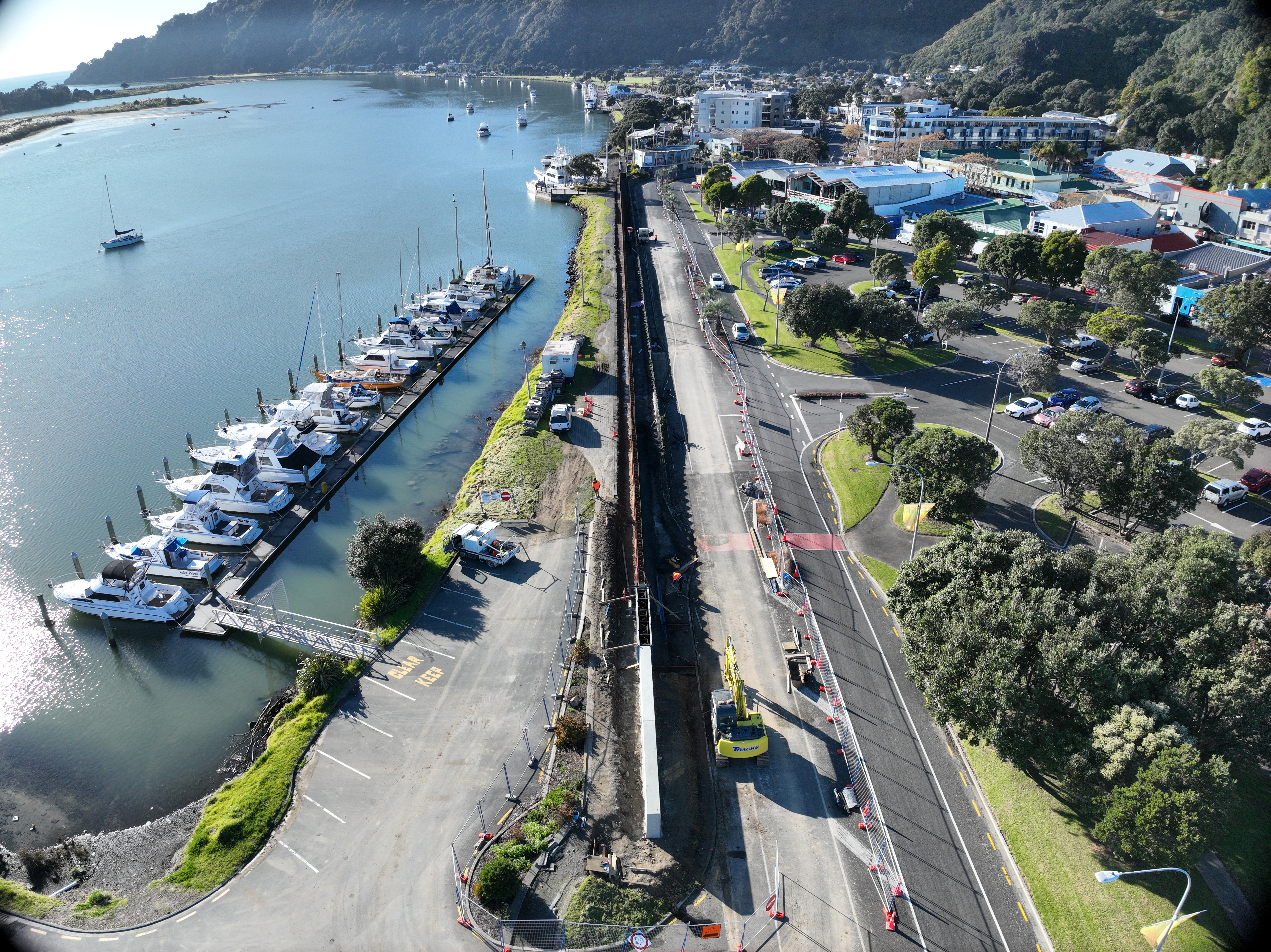
Installation of the sheet piles is complete. The next step is to cover the sheet piles in concrete to form the finished floodwall. This is due to be done in June 2024.
We’ve started earthworks to raise the height of the stopbanks between the Yacht Club and skate park.
What’s the latest update with Project Future Proof?
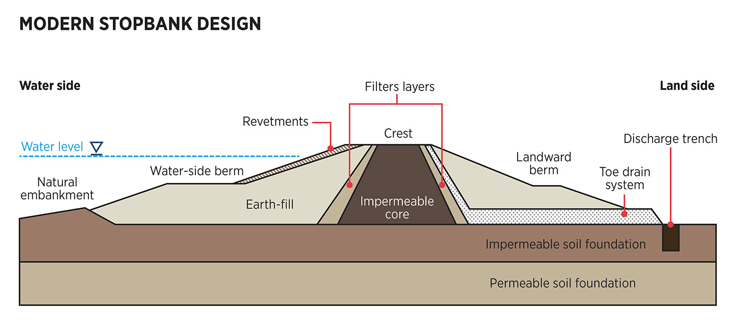
No – the sheet piles are made of carbon steel, which is hard wearing and designed to be exposed to the elements. Covering them in concrete is to make the floodwall look as nice as possible.
Is there any risk of leaving the sheet piles exposed?
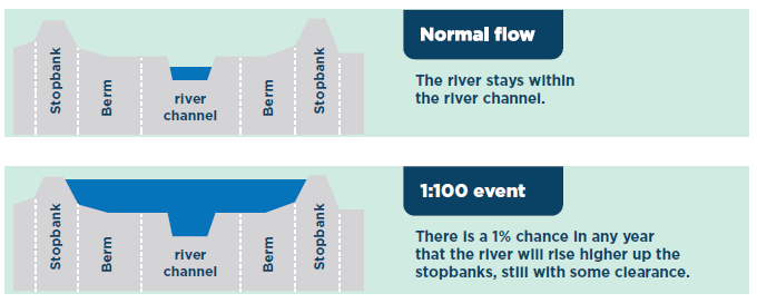
Yes – the sheet piles are designed to be effective both above ground and below.
Above ground they will help stop rising water from entering the town in a large-scale event.
Below ground they help slow the flow of any water passing through the stopbank and reduce the risk of uncontrolled seepage occurring.
Will the exposed sheet piles be effective if we have a flood?
Yes – we’re currently working with our partners Te Runanga o Ngāti Awa and Whakatāne District Council on the process to develop this design narrative. The artwork is likely to be on the concrete panels in early 2025.
Is a design going on the floodwall?
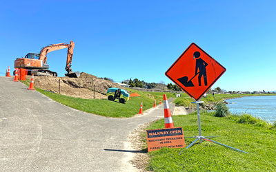
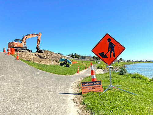
We are due to re-open both lanes of Kakahoroa Drive and the floodwalls section of the Warren Cole Walkway in July 2024. This will happen once the concrete panels have been installed and we have constructed a seepage trench along the roadside (a seepage trench collects controlled seepage moving through the stopbank towards the roadside. This water is then pumped back into the river).
When will the road and walkway re-open?
Stage One of the flood defence upgrade in Whakatāne CBD is making good progress heading into winter. There’s a lot happening in this space, so we’ve put together a few FAQs.
Other council news
Te Mahere Tūroa: Long Term Plan 2024-2034 consultation
We would like to acknowledge everyone in the community who participated in consultation for Te Mahere Tūroa, the draft Long Term Plan (LTP).
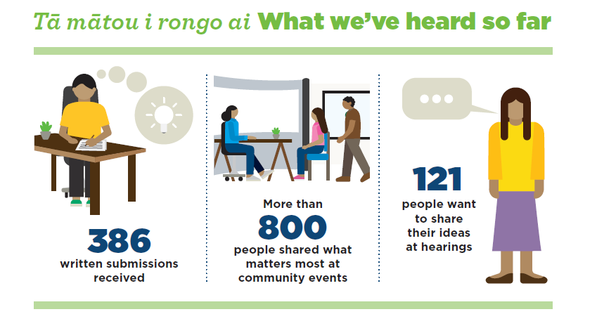
A total of 386 LTP submissions were received from individuals and groups. During the consultation period, which ran from 8 March to 9 April 2024, 800 people attended five community events across the rohe. These events proved an invaluable forum to share ideas and gain feedback on what mattered most to communities.
Of the 386 submissions, 121 submitters have asked to speak to councillors as part of their submission. Staff will be in touch with these submitters soon to confirm dates, times and venues.
LTP hearings, the forums where submitters can talk to councillors about their submission, are currently scheduled for 10, 14 to 16 May. Regional Council will consider the information shared and gained at these hearings prior to adopting the final LTP in June 2024.
The adopted LTP will cover the period 2024 - 2034 and will officially start on 1 July this year.