We monitor and manage the taking of water from the region’s rivers, streams, lakes and aquifers, to ensure that water is used efficiently and that our waterways are well cared-for.

Climate change is bringing hotter, drier summers to our region, and our natural water sources are already showing signs of stress. Flow levels in some western Bay of Plenty streams dropped to record lows in March – May 2020, following several months of exceptionally dry weather. In addition, a large area of the region to the west and north of Rotorua experienced very low flows through the first half of 2021 which continued on until mid-2022.

We all need to forward-plan and reduce water use where we can, to keep our local waterways, wildlife, and people’s lives and livelihoods healthy, now and in the future.

Regional plan rules and consent conditions are in place to keep waterways healthy under usual weather conditions.

In exceptional circumstances, regional councils can also put temporary extra water use restrictions in place where needed to protect waterways from environmental harm. These take the form of a Water Shortage Direction (WSD) under s.329 of the Resource Management Act.

Current situation

Latest update: 3 November 2022

level 0Whole of the Bay of Plenty – Level 0

Streams, groundwater and rainfall within expected range.

Water Shortage Standard Operating Procedure (July 2021)

The following Levels can be in place for the whole of the Bay of Plenty, or only apply to certain Focus Zones. Focus Zones can refer to specific waterbodies, whole catchments, multiple catchments, or districts. The Focus Zones will always be identified via a Focus Zone map.

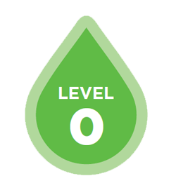
level 0

No water shortage concerns

Streams, groundwater and rainfall within expected range. No issues of concern.

  • Normal BAU review of data from Council’s monitoring network
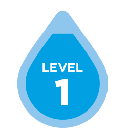
level 1

Reducing water availability

Lower than expected levels of any of the following occurring: rainfall, stream flows, groundwater and/or soil moisture.

  • Appoint Water Shortage Manager
  • Increased review of stream, soil and groundwater state
  • Analysis of short and long-range weather forecasts
  • Review and refresh (if needed) Stakeholders Communications Plan
  • Update webpage
  • Commence issuing of regular Situation Reports (usually 1-2 monthly)
level 2

Impending water shortage

Any or all of the following occurring: continued reduction in stream flows and/or groundwater levels, lack of rainfall i.e. growing risk to waterway health.

  • Closer assessment of forecasts, rainfall, stream, soil and groundwater state
  • Convene subject matter expert meeting to evaluate all available data
  • Increase frequency of Situation Reports (at least monthly) – place on website
  • Define catchments/waterbodies of interest (known as Focus Zones)
  • Generate list of potentially affected consent holders (ensure contact details are accurate)
  • Communicate as per Stakeholders Communications Plan – keep webpage updated
  • Specifically, inform consent holders, iwi/ hapū, Councillors, stakeholders, local authorities within Focus Zones of elevated risk of water shortage event
level 3

Water shortage event

Low flow and/or drought conditions affecting waterways i.e. risk to waterway health

  • Focus Zone Situation Reports increased to every two weeks (unless no change)
  • Convene Water Shortage Decision Group (WSDG) made up of at least four of the following: GM Regulatory Services, GM Integrated Catchments, Environmental Data Services Manager, Science Manager and a Regulatory Compliance Manager (or a senior/experienced delegate)
  • The WSDG shall review recommendations from Water Shortage Manager, including any possible Water Shortage Direction before recommending to CE for approval
  • CE approves issuing a Water Shortage Direction as allowed for by s.329 RMA
  • Inform affected consent holders, iwi/hapū, Councillors and stakeholders at least 5 working days prior to issuing a Water Shortage Direction (NB: this may not always be possible)
  • Increase compliance monitoring of consented and unconsented (where possible) water takes and discharges (if relevant)
  • Water Shortage Manager to review Water Shortage Direction every 14 days. Decision to cancel or reissue to be reviewed by WSDG, prior to CE approval (if decision is to re-issue)

We collect real-time rainfall, river level, stream flow and soil moisture data from more than 100 monitoring sites throughout the region. Check out the map links below for:

See our Environmental Data Portato access more environmental monitoring information for your particular area.

Assistance is available for farmers and growers who are affected by drought through their industry networks.

We work with MPI, Rural Support Trust and local industry representatives through the Bay of Plenty Primary Sector Co-ordination Group to support a co-ordinated regional drought response.

Whether your water comes from a bore, stream or town supply, we can all take steps to reduce water use. Here’s some links to help get you started:

If you’re concerned about illegal water use, unusually low stream flows, or if your bore has dried up, please let us know by calling our 0800 884 883 Pollution Hotline. 

You will need to apply for a resource consent if you want to take water for any purpose other than for reasonable domestic household or stock drinking use, if:

  • You are taking more than 35,000L per day (35m3/day) from a groundwater source (bore, well); or
  • You are taking more than 15,000L per day (15m3/day) from a surface water source (river, stream, spring, pond, drain), or are taking at a rate of more than 2.5 litres per second.

You can enquire online or give our Duty Consents Officer a call on 0800 884 881 extn. 9090 to check if your water use requires a consent. Find out more on our water take consents web page or by emailing consents.queries@boprc.govt.nz.

All consent holders that take more than five litres of water per second, and most new consent holders taking at a rate less than this, are required to accurately measure and report on their actual water use. In most cases, this means that the water meter information will be required to be telemetered to Council. See our water metering web page for details.

See our interactive map of current resource consents for details of all water-use and other resource consents issued by Bay of Plenty Regional Council.

Further information

Updates

about 2 years ago

Dry summer sees reactivation of Rotorua Focus Zone

Bay of Plenty Regional Council staff will increase water flow monitoring of several Rotorua Focus Zone streams as the area moves into Level 1 of a Water Shortage Event.

Regional Council Water Shortage Event Manager Steve Pickles said water flows in the Paraiti (Mangorewa), Waiari and Ngongotahā streams in particular are continuing to decline due to dry conditions. These streams all have their headwaters originating from the west and north of Lake Rotorua.

2022-01-14 - Dry summer sees reactivation of Rotorua Focus Zone

Bay of Plenty Regional Council staff will increase water flow monitoring of several Rotorua Focus Zone streams as the area moves into Level 1 of a Water Shortage Event.

Regional Council Water Shortage Event Manager Steve Pickles said water flows in the Paraiti (Mangorewa), Waiari and Ngongotahā streams in particular are continuing to decline due to dry conditions. These streams all have their headwaters originating from the west and north of Lake Rotorua.

The Rotorua Focus Zone, which includes streams with their headwaters in the Mamaku ranges, was established last summer when some of the lowest-ever stream flows were recorded in the area.

“We’ve entered the summer period with lingering drought conditions from the previous two years’ low rainfall,” said Mr Pickles.

“Raising the alert level for these streams to Level 1 signals to water users in the Rotorua Focus Zone that there could be a need for intervention if dry conditions continue. Water restrictions for consented water users would only occur if the area moved to Level 3.

“Regional Council staff are now increasing monitoring of the streams and will be contacting consented water users in the zone to advise them of the elevated alert level.”

Mr Pickles said rainfall over the next three months is forecasted to be near average however, due to the current La Niña conditions, rain is expected to fall in heavy bursts with long dry periods in-between.

Regular periods of steady rain will likely be needed to halt the Rotorua Focus Zone streams’ declining trend.

If the alert level is raised to Level 3, Regional Council may have to impose water restrictions on users to ensure the health and mauri of the streams and the wildlife they support from harm are maintained.

“As advised last year, water users need to be preparing and planning for water restrictions if the dry weather conditions continue. In the meantime everyone, including rural, urban and commercial users, can do their part by making sure they are using water efficiently and not wasting it,” said Mr Pickles.

There are four alert levels, Alert Level 0 no water shortage concerns, Alert Level 1 reducing water availability, Alert Level 2 impending water shortage and Alert Level 3 water shortage event.

The rest of the Bay of Plenty remains in Alert Level 0.

ENDS

For  further media information, please contact media@boprc.govt.nz 

map
Map showing the Rotorua Focus Zone. 

about 3 years ago

Regional council keeps eye on rivers

Bay of Plenty Regional Council Toi Moana is keeping a close eye on river and groundwater levels as we head into summer off the back of two very dry years.

The last two summers have seen some streams in the Bay of Plenty reach their lowest ever recorded flows, but Water Shortage Event Manager Steve Pickles said there may be some relief this year.

2021-11-11 - Regional council keeps eye on rivers

Bay of Plenty Regional Council Toi Moana is keeping a close eye on river and groundwater levels as we head into summer off the back of two very dry years.

The last two summers have seen some streams in the Bay of Plenty reach their lowest ever recorded flows, but Water Shortage Event Manager Steve Pickles said there may be some relief this year.

Weather predictions show that rainfall this coming summer is expected to be normal and after some recent rainy weather we are already experiencing a promising increase in some river flows.

“Most of our rivers are in a healthy state as we enter summer but we are carefully watching the streams flowing from the Kaimai and Mamaku ranges which have experienced very low flows this year,” said Mr Pickles.

Groundwater levels are stable when compared to last year but will likely decrease heading into summer.

“Groundwater follows a seven-to-10-year recharge cycle and we appear to be in a lower recharge cycle at the moment,” said Mr Pickles.

“In areas where there is lower rainfall, we may see some shallow wells drying up and smaller streams and springs with reduced flow.”

The Regional Council is responsible for caring for the region’s waterways and ensuring people’s use of water is sustainable and has ongoing monitoring in place to check that healthy base flow levels are maintained in the region’s rivers, streams and aquifers.

“In dry summers, we do extra monitoring to ground-truth automatic gauges and check on smaller waterways where we don’t have live monitoring in place,” said Mr Pickles.

“There are many tools we at the Regional Council can employ to protect the mauri of the water but across the region, everybody can also do their part to help to care for local waterways.

“Water users should check for leaks in their systems, and take steps to always use water as efficiently as possible to avoid wasting it.”

For further media information, please contact media@boprc.govt.nz 

about 3 years ago

Risk of water restrictions eased

Streams with catchments in the headwaters to the west-southwest of Rotorua, a 60,000-hectare area known as the Rotorua Focus Zone, have been experiencing very low flows throughout the first half of this year.

During this period, both the Paraiti and Ngongotahā streams have at times recorded their lowest ever flows since permanent monitoring began.

2021-07-14 - Risk of water restrictions eased

Streams with catchments in the headwaters to the west-southwest of Rotorua, a 60,000-hectare area known as the Rotorua Focus Zone, have been experiencing very low flows throughout the first half of this year.

During this period, both the Paraiti and Ngongotahā streams have at times recorded their lowest ever flows since permanent monitoring began.

After the rain events in June, Toi Moana has made the decision to move back to Level 1.

There are three alert levels to a dry weather event – Level 1: normal water availability, Level 2: impending water shortage, and Level 3: water shortage event.

Unless there is significant rain over the next few months, the region will likely head into the summer of 2021/22 in a worse starting position that last year. So water users taking water from streams and rivers should be planning for possible restrictions for the future.

about 3 years ago

Dry weather takes its toll on stream flows in Rotorua region

Bay of Plenty Regional Council are implementing Level 2 of the Water Shortage Event Standard Operating Procedure for some streams with headwaters in the west-southwest of RotoruaRead more.

Show More