Your guide to managing mangroves in Tauranga Harbour.
Mangroves play an important role in the ecology of the Tauranga Harbour, they provide a buffer against coastal erosion and storm surge and are a nursery ground for species such as short finned eel and yellow eyed mullet.
They're also home to many native insects, birds, shellfish, snails, crabs and algae. However, too many mangroves can create problems in the harbour.
Changing land use has caused more sediment and nutrients to enter the harbour.
These extra nutrients have caused more mangroves to grow to the point where they are taking over large areas of the open tidal flats, especially in the sub-estuaries (i.e Te Puna, Waikareao and Waimapu estuaries).

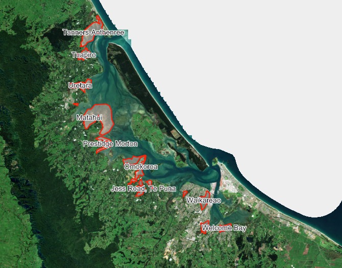
The Bay of Plenty Regional Council supports care groups and landowners to reduce sedimentation to restore parts of the harbour and stop the spread of mangroves. If you would like to manage mangroves in your area, use the map below to see what activity is permitted in your area.
How to use the Mangrove Manager Web App:
- View the locations below for more information. If your area is not located on the map, select the 'Other areas' map.
- Work through the questionnaire to find out if your mangrove management activity is permitted.
Shrewsbury Street
Welcome Bay
Uretara
Waikareao
Tuapiro
Athenree-Tanners Pt
Waikaraka
Omokoroa
Jess Road, Te Puna
Contact us
For more information, email consents.queries@boprc.govt.nz or phone 0800 884 881 x9090.
The consents team offers one hour of free pre-application advice.


