To receive our occasional Kaituna Maketū e-newsletter, please subscribe here. See our most recent edition:
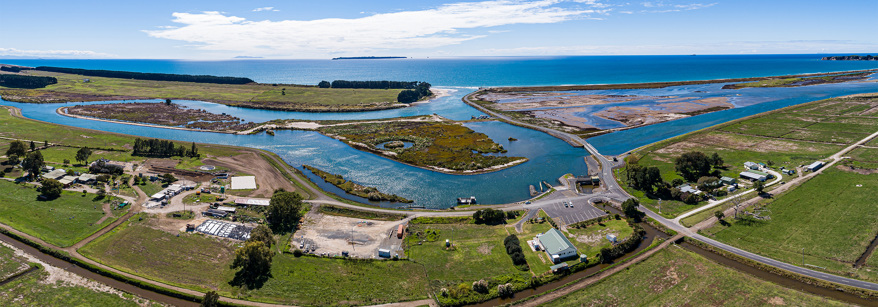
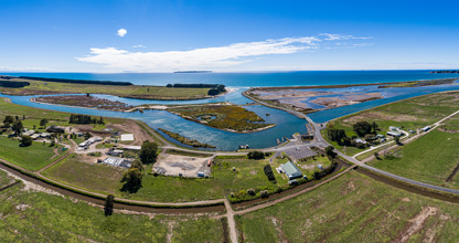
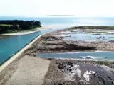
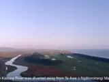
We’re making Te Awa o Ngātoroirangi/Maketu Estuary healthier for people to swim and fish in.
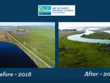
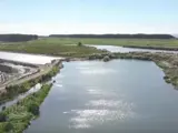
We've restored up to 20 percent of the Kaituna River's freshwater flows into the estuary. We’ve also re-created 20 hectares of wetlands around the estuary margin, to help filter nutrients and create breeding areas for birds and fish.
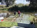
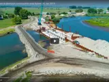
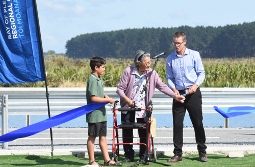
Construction work began in June 2018 and its completion was publicly celebrated with karakia and a ribbon-cutting ceremony to mark the opening of new re-diversion control gates on Wednesday 12 February 2020. The project was completed on budget and 5 months ahead of schedule. All construction works have been completed.
See video clips from the opening celebration and previous project progress updates.
All of the resource consents and conditions for the project were finalised in an Environment Court decision issued in May 2016. All of the land acquisitions and detailed designs for the project were then completed before construction began. See a map of publicly owned land around the estuary.
Project updates and monitoring
Project progress and monitoring results were reported on annually and updates given to the community at quarterly public meetings during construction works. Monitoring is continuing and public update sessions will be held annually for five years following the 12 February 2020 commissioning of the diversion control gates.
Follow this project page or subscribe to our e-newsletter below to receive occasional email updates and notification when the date is set for the next public information session.
- Presentation to public meeting 23 August 2022
- Presentation to public meeting 28 July 2021
- Presentation to public meeting 21 July 2020
- Presentation to public meeting 12 December 2019
- Presentation to public meeting 18 September 2019
- Presentation to public meeting 12 June 2019
- Presentation to public meeting 13 February 2019
- Presentation to public meeting 7 November 2018
- Kaituna Re-diversion Annual Monitoring Report 2020-2021
- Kaituna Re-diversion Annual Monitoring Report 2019-2020
- Ken Phillips final report on archaeological investigation associated with HNZ authority 2018/331 - Kaituna Re-diversion project
- Maketu Estuary ecology monitoring report - June 2020
- Kaituna River re-diversion opening celebrated
Resource consent documents
Resource consent and land designation decision documents
- Decision of the Environment Court 18 May 2016
- Resource Consent and Notice of Requirement decision report 1 July 2015
- Resource consent conditions 1 July 2015
- Land designation conditions 1 July 2015
- Plans
- Designation plan
- Plan 1 - proposed construction works
- Plan 2 - proposed Ford Rd realignment
- Plan 3 - proposed Ford Rd realignment cross-sections part 2
- Plan 4 - proposed Ford Rd realignment cross-sections part 3
- Plan 5 - proposed culvert installations
- Plan 6 - Fords loop channel plan
- Plan 7 - proposed channel and exiting Ford's cut channel remedial works
- Plan 8 - proposed channel and existing Fords cut cross sections part 1
- Plan 9 - proposed channel and existing Fords cut cross sections part 2
- Plan 10 - land use plan
- Plan 11 - Papahikahawai Island remediation plan
- Plan 12 - resource consent monitoring sites plan
Resource consent and notice of requirement application documents
Kaituna River Re-diversion and Ongatoro/Maketu Estuary Enhancement Project Notice of Requirement and Resource Consent Application, lodged July 2014:
Volume A: Assessment of Environmental Effects
- Assessment of Environmental Effects Report
- Appendix 1 Plan Schedules
- Appendix 2 Relevant Objectives and Policies
- Appendix 3 Proposed Conditions
Volume B: Technical Reports
- Summary and Analysis of Options and Alternatives, BOPRC 2013
- Full Pre Consent Consultation Report, Opus 2013
- Numerical Modelling, DHI 2014 Part 1
- Numerical Modelling, DHI 2014 Part 2
- Maketu Estuary: Effect of Proposed Rediversion on Coastal Erosion, ECONOMOS, 2014
- Summary of effects resulting from water level changes, Waterline 2014
- Terrestrial avian wetland restoration ecology assessment of environmental effects, Opus 2014
- Ongatoro Maketū estuary condition and potential ecological effects, River Lake 2014
- Microbiological health risk of bathing and shellfish gathering in the Maketū estuary, River Lake 2014
- Extent of wetland vegetation in Maketu Estuary 1939 to 2011, BOPRC 2014
- Maketu social and recreational use impacts assessment report,BOP Polytechnic 2014
- Construction Description and Drawings, Waterline 2014
- Cultural Impact Assessments, various 2014
Volume C: Drawing Set
- Designation Plan, Opus 2014
- Construction drawings, Waterline & Opus 2014
- Cover Sheet
- 01 Location Plan and general layout plan of land ownership & existing features
- 02 Proposed Construction works
- 03 Proposed Ford Road re-alignment - Plan and longsection - Sheet 1 of 2
- 04 Proposed Ford Road re-alignment - Plan and longsection - Sheet 2 of 2
- 05 Proposed Ford Road parking and boat ramp
- 06 Proposed Ford Road parking and boat ramp - vehicle turning paths
- 07 Proposed Ford Road re-alignment - cross sections - sheet 1 of 7
- 08 Proposed Ford Road re-alignment - cross sections - sheet 2 of 7
- 09 Proposed Ford Road re-alignment - cross sections - sheet 3 of 7
- 10 Proposed Ford Road re-alignment - cross sections - sheet 4 of 7
- 11 Proposed Ford Road re-alignment - cross sections - sheet 5 of 7
- 12 Proposed Ford Road re-alignment - cross sections - sheet 6 of 7
- 13 Proposed Ford Road re-alignment - cross sections - sheet 7 of 7
- 14 Proposed culvert installations - plan and longsection and typical section
- 15 Ford's Loop channel- plan and section 'A-A'
- 16 Proposed channel and existing Ford's cut - channel remedial works - plan & sections
- 17 Proposed channel and existing Ford's cut - cross sections - sheet 1 of 2
- 18 Proposed channel and existing Ford's cut - cross sections - sheet 2 of 2
- 19 Land use plan
- 20 Papahikahawai Island - remediation plan
Further information:
- Further information request, August 2014
- Further information response, September 2014
Post lodgement documents:
- Technical note: Kaituna landscape and visual effects, January 2015
- Frequently asked questions: Kaituna re-diversion effects on boating, January 2015 Alternative Ford Road boat ramp and parking facilities Notice of Requirement and Resource Consent Application, lodged December 2014:
Assessment of Environmental Effects
- Appendix 1 - Designation plan for boat facilities
- Appendix 2 - Proposed construction works plan
- Appendix 3 - Proposed road re-alignment plan
Hearing documents
Agenda for 4-8 May hearing on resource consents and NOR applications:
- Part 1 p.1-142
- Officer's Report
- Appendix 1 - Appendix
- Part 2 p.143-199
- Appendix 3 continued
- Appendix 4 - Appendix 5
- Part 3 p.200-215
- Appendix 5 continued
- Appendix 5 continued
- Part 4 p.216-371
- Appendix 5 continued
- Appendix 6 - Appendix 9
- Part 5 p.372-462
- Appendix 9 continued
- Part 6 p.463-546
- Appendix 9 continued
- Appendix 9 continued
- Part 7 p.547-1035
- Appendix 9 continued
- Appendix 9 continued
- Part 8 p.1036-1345
- Appendix 10 - Appendix 25
- Part 9 p.1346 - 1351
- Appendix 25 continued
Evidence briefs from project team
- Jim Dahm on coastal processes
- Steve Everitt on hydrological engineering
- Keith Hamill on ecology
- Martin Single on bar navigability
- Ben Tuckey on modelling
- Roger MacGibbon on flora, fauna and wetland restoration
- Steph Brown on AEE and statutory processes
- Pim de Monchy on project, background and processes
- Kaituna River Re-diversion and Wetland Creation Project Assessment of Environmental Effects Summary May 2014
- Kaituna River re-diversion and wetland creation project: scoping report for assessment of environmental effects
- Kaituna River re-diversion full pre-consent consultation report
- Summary of pre-consent consultation responses
- Kaituna-Maketu re-diversion project: option pre-feasibility and consentability
- Water Quality Survey of the Lower Kaituna Catchment 2007 - 2008 (very large document)
- Kaituna Re-diversion Wetland Creation Project Summary and Analysis of Options paper
- DHI Kaituna River to Maketu Estuary re-diversion Model Calibration and Initial Hydrodynamic Impact Assessment Part 1 (very large document)
- DHI Kaituna River to Maketu Estuary re-diversion Model Calibration and Initial Hydrodynamic Impact Assessment Part 2
- DHI Kaituna River to Maketu Estuary re-diversion Model Calibration and Initial Hydrodynamic Impact Assessment Part 3
- 1959 Ministry of Works Hydraulic Engineering Report
- 1991 Bergin report - Experimental Restoration of Indigenous Salt Marsh Maketu Estuary
- 2003 Keith Owen DOC Science Technical Report 26 Distribution and Conservation of Shorebirds in the Bay of Plenty 1994 - 2003
- 2012 06 Report on water quality monitoring Ohau Wall Lake Rotoiti
- Intertidal shellfish survey within Maketu Estuary Bay of Plenty New Zealand 2012
- Lower Kaituna River Maketu Estuary water quality modelling Final report
- Kaituna River re-diversion Social and Recreational Use Patterns Heather R Hamerton
- Operations Publication 2005/01 - Kaituna River Major Scheme Hydraulic Review
- Operations Publication 2008/08 - Kaituna River to Maketu Estuary rediversion recommended options
- Environmental Publication 2007/16 - Lower Kaituna Catchment and Water Quality
- NIWA - Baseline Study of the Potential Impact of Increased Trout Numbers in the Kaituna River on Whitebait, 2005
- P Wallace - Ford's Cut history and bank erosion assessment, 2008
- P Wallace - Hydraulic modelling of the Kaituna River, 2009
- P Wallace - Rediversion of Kaituna River into Maketu Estuary Hydraulic Modelling and Costing, 2007
- Wildlands Consultants - Vegetation and Habitat Types of the Lower Kaituna River, Western Bay of Plenty
Technical reports that are available by contacting the Bay of Plenty Regional Council:
- 1986 Bay of Plenty Catchment Commission Maketu Estuary Study Stage 1 Report KRTA 1986 (Objective id A1640741)
- 1987 Julie Burton Thesis on Maketu Estuary tidal inlet hydraulics and stability (Objective id A1698891)
- Ecology and Geomorphology of Maketu Estuary Bay of Plenty Thesis of Kenneth Murray 1978 Up to chapter 6 (Objective id A1671822)
- Ecology and Geomorphology of Maketu Estuary Bay of Plenty Thesis Kenneth Murray 1978 Chapter 7 to end (Objective id A1671885)
- Hydrodynamic and Water Quality Modelling of the lower Kaituna River and Maketu Estuary Thesis by Nigel David Goodhue (Objective id A73847
- Kaituna River to Maketu Estuary Re-diversion Report Model Calibration and Initial Hydrodynamic Impact Assessment January 2009 (Objective id A226068)
- Maketu Estuary Environmental Issues and Options Commission for the Environment Wellington NZ 1984 (Objective id A1637550)
- Maketu Estuary Restoration Strategy A Proposal to Central and local Government Coordinated by Department of Conservation March 1989 (Objective id A1629567)
Project goal
The goal of the Kaituna River Re-diversion and Estuary Enhancement Project is to significantly increase the volume of water (particularly fresh water) flowing from the Kaituna River into Te Awa o Ngātoroirangi/Maketū Estuary by 2018 in a way that maximises the ecological and cultural benefits (particularly wetlands and kaimoana) while limiting the economic cost and adverse environmental effects to acceptable levels.
The re-diversion has been designed to maximise the flow into the estuary while keeping Te Tumu cut open for flood protection and boating access.
Key contact
For questions, complaints or feedback about this project, please contact the Project Manager, Pim de Monchy, on 0800 884 880 or use the feedback form below.
Project updates
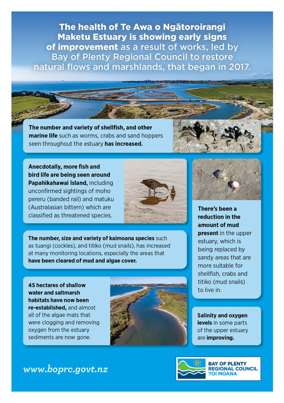
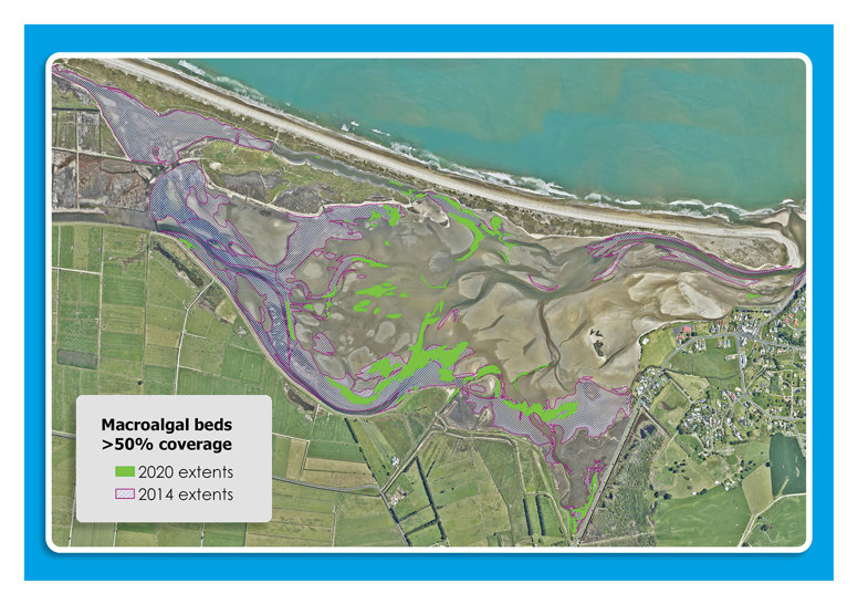
The health of Te Awa o Ngātoroirangi Maketu Estuary is showing early signs of improvement as a result of works, led by the Bay of Plenty Regional Council to restore natural flows and marshlands, that began in 2017.
The Kaituna River Re-diversion and Te Awa o Ngatoroirangi / Maketū Estuary Enhancement Project was announced this week as the 2020 winner of the Terry Healy Coastal Project Award from the New Zealand Coastal Society (NZCS).
We are honoured, together with our consultancy firm WSP, to have received the New Zealand Planning Institute Rodney Davies Project Award yesterday for the Kaituna River re-diversion and Te Awa o Ngātoroirangi Maketu Estuary enhancement project.
On Wednesday 12 February, the Maketu community joined us in celebrating the opening of the Kaituna River re-diversion control gates the partial return of freshwater flows into Te Awa o Ngātoroirangi/Maketu Estuary.
Kaituna River re-diversion construction works are almost complete, with final checks and tests being run on the control gates from 28 Jan – 9 Feb.
Ford Road boat ramp, on the Kaituna River near Maketu will be open for public use from 24 December 2019.
Te Kaiamo Okeroa Rogers-Smith has completed a fabulous new mural on the gate control building that’s been built at Ford Road as part of the project.
Whitebait fishers are being asked for their patience again this season, so that speedy progress on the Kaituna River re-diversion project can continue.
The Kaituna River rediversion project marked a significant milestone on 26 June, with the opening of the first of 12 culverts to restore freshwater flows into Te Awa o Ngatoroirangi / Maketu Estuary.
Ngati Whakaue ki Maketu kaumatua Liam Tapsell led karakia to mark the occasion, accompanied by Te Maru o Kaituna chairman Dean Flavell, contractors and Regional Council project leaders.
The first culvert returns the flow to the level present before construction began. At the end of this year, the majority of the 12 culverts will be opened, significantly increasing the re-diverted flow (this is called Stage 1 Commissioning). These increased flows will be monitored for 12 months before full commissioning of all the culverts, which will restore 20 percent of the Kaituna River’s historic flow to the estuary.
The $16m project remains six months ahead of its scheduled completion date.
Around 4,500 seedlings are putting down roots in the Ford Road wetland, Te Pa Ika, after the community got behind the Bay of Plenty Regional Council planting days held in late June, in conjunction with Sustainable Coastlines.
Fifty-five people attended the public day, following a great effort at the rangatahi day, which saw 190 students put in 2,000 plants.
Meeting details: 5.30pm Wednesday, 12 June 2019 at Tukotahi Marae, 83 Ford Road.
Work to partially redivert the Kaituna River and make Te Awa o Ngatoroirangi/Maketū Estuary healthier is progressing well, and ahead of schedule. Interested community members are invited to attend Wednesday’s meeting to hear the latest project updates from Bay of Plenty Regional Council.
Please note: With winter upon us, there will be no site tour. The format of the meeting is a presentation followed by questions.
J Swap Contractors and the project team continue to make excellent progress and are on track for Stage 1 commissioning of the new culverts before Christmas, about six months ahead of schedule.
Construction work on the Kaituna River re-diversion project is now about one-third of the way through and progressing well ahead of schedule.
Read the December 2018 Newsletter.
A new camera has been installed above Bay of Plenty’s most dangerous bar - the Kaituna Cut, giving boaties an up-to-date look at the bar conditions.
More than 136 kilometres of Bay of Plenty waterway margins have been protected from stock access in the past year through riparian management partnerships between private landowners and the Bay of Plenty Regional Council.
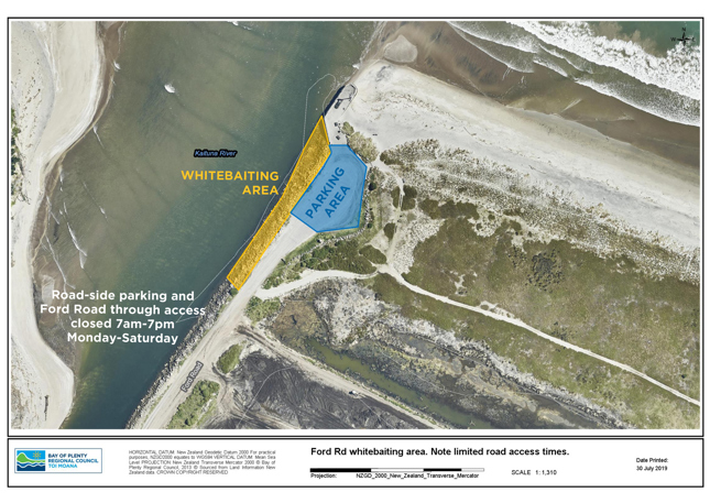
While local fishermen have settled in to new spots for boat launching and surfcasting since the temporary closure of Ford Road took effect on 1 August, Regional Council staff are encouraging whitebaiter fishers to also look for new options with the opening of the whitebait fishing season this week.
Ford Road access to Te Tumu Cut and Maketū Spit will be closed from 1 August until 20 December, to enable construction work that will restore 600,000 cubic metres of freshwater flows into Te Awa o Ngatoroirangi Maketū Estuary on every tidal cycle.
Briefing notes and meeting notes from the group's sixth workshop, held on 20 September are now available online.
The group discussed catchment modelling assumptions and scenarios, They also explored land and water use values.
More than 100 people, including representatives from six Te Arawa iwi gathered at Tukotahi Marae yesterday, beside the Kaituna River, to celebrate the start of construction works that will return freshwater flows from the river into Te Awa o Ngatoroirangi Maketū Estuary.

