

Flood Protection and Drainage Bylaws
These Bylaws provide protection from damage and misuse to flood protection and drainage infrastructure assets managed by or under the control of Regional Council.
These assets have been built to increase productivity of land, and prevent damage, danger, and distress to the community from flooding, and problems associated with a lack of drainage. It is crucial they function properly when needed.
These Bylaws apply to:
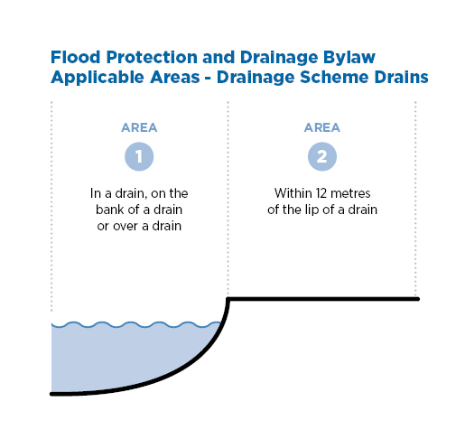
- Drainage scheme drains and canals.
- Defences against water such as stopbanks, flood walls, pump stations and flood gates.
- Erosion protection, such as rock protection, willow and native plantings.
- Floodways, spillways and ponding areas.
You can check our Quick Guide to see an overview of how the Bylaws are applied.
If you have a flood defence or drainage asset on your property, it’s important to know how the Bylaws may impact you – including if and / or when you will need a Bylaw Authority.
What is a Bylaw Authority?
Building, digging, planting or doing earthworks near a Regional Council flood protection and drainage infrastructure asset may require a Bylaw Authority before you get started.
A Bylaw Authority is written permission from Regional Council that includes conditions to ensure flood protection and drainage infrastructure assets are not damaged or compromised.
A Bylaw Authority doesn’t stop you from doing work on your land. It is there to ensure any work carried out doesn’t accidentally affect the integrity of our flood protection and drainage infrastructure assets (which help keep us all safe in major floods).
Find out what activities require a Bylaw Authority and what information is required.

We can email you application material and guidance on the information you’ll need to supply.
Where do the Bylaws apply?
If you are planning any work along one of the region’s rivers please contact us for advice on whether you need to apply for a Bylaw Authority.
Activities that need a Bylaw Authority
When applying for a Bylaw Authority, you will need to provide information specific to the work you intend to carry out.
For all applications you need to provide:
- Your contact details
- Property address
- Details about when you plan on starting and/or completing the works.
If you are unsure, or have any questions, please get in touch with our Regional Council team to check if the work you’re planning needs an application for Bylaw Authority and we will get back to you with advice specific to your property.
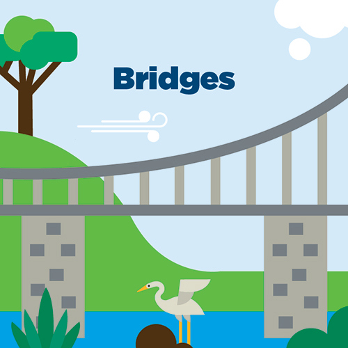
Bridges – please provide:
- Details about the removal of any existing bridge/s
- Location of the new bridge
- Purpose of bridge e.g. type of traffic expected to use the bridge
- Detailed bridge design
- Information about an alternation to the existing access to the drain around the bridge or over stopbanks
- Erosion protection.

Building dwellings, garages and sheds – please provide:
- Confirmed location of the dwelling, garage or shed within the property boundary
- Details of site preparation work and recontouring e.g. building platform, removal of any existing structures or shrubs, hedges, trees
- Foundation design information (including decks) and any related geotechnical information
- Details about how stormwater and wastewater will be managed
- Information on any new inground connection services e.g. power, water, wastewater
- We will need to understand the location, depth, how the services are being installed
- Details on associated activities that require earthworks or digging into the ground e.g. areas of hard surface (e.g. driveway, large paved areas) fencing (removal of existing and constructing new), landscaping and planting, tree removal, inground clothesline structure etc.

Culverts – please provide:
- The location of the culvert
- Culvert specifications, including length, diameter, depth, invert, material
- Proposed erosion protection/headwall design
- Details on 'sizing the culvert'
- We can provide a culvert sizing services as part of the application process with the cost charged to you - please contact us for an estimated cost. Alternatively, you can engage a suitably qualified professional to do the culvert sizing and provide the calculations with the application
- Details of the flood gate (if applicable) or other backflow preventer
- Details on associated activities proposed within the drain or within 12 metres of the drain edge e.g. fences, plantings, services, pipelines.
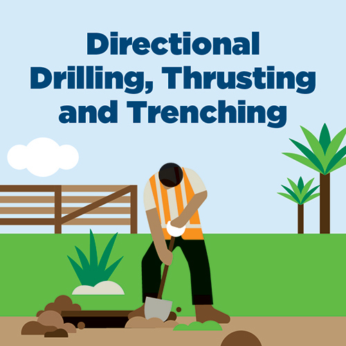
Directional drilling, thrusting and trenching – please provide:
- Location of planned works
- Methodology (e.g. thrusting, directional drilling, trenching)
- Will the works be carried out in a saltwater environment
- Outline of the details for the works (depth, width and proposed backfill).
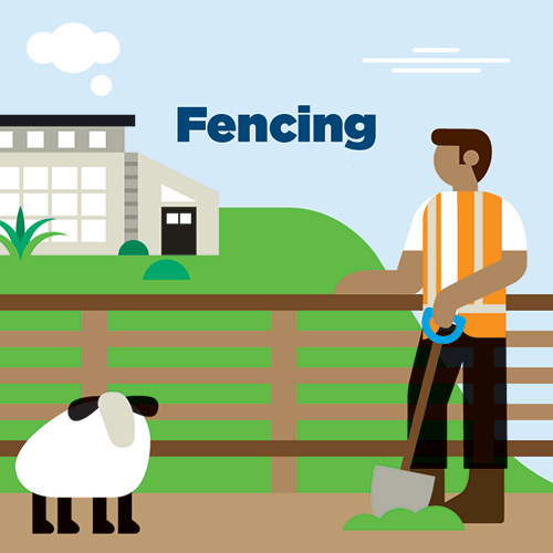
Fencing – please provide:
- Location, in relation to stopbank
- What are the dimensions of the fence materials to be used?
- The number of posts being used and their depth in the ground
- Information on the foundation construction (e.g. concreting in the post or rammed earth)
- Will the posts be driven or dug?
- Do you plan on providing a mowing strip?

Geotechnical testing – please provide:
- A map showing the test locations
- Details about the proposed tests (type, depth and backfill methodology)
- If a rig is being used, does it have screw anchors?
- If so, what are the standards operating procedures for backfilling anchor holes?

Horticultural development – please provide:
- Confirmed locations of development structures, planting or earthworks and associated details for each
- Examples include water intake structures; irrigation; sub-surface drainage; artificial shelter; natural shelter; support structures; building foundations; land contouring; pump sheds and water tanks
- Details required for each, including site preparation work and recontouring e.g. building platform, removal of existing structures or shrubs, hedges, trees
- Information on any new in-ground connection services e.g. power, water
- We'll need to understand the location, depth, how the services are being installed
- Geotechnical information (including seepage analysis) of the site to help determine any remedial measures
- For example, any posts for support structures within a certain distance of a stopbank may require filter collars to be installed.
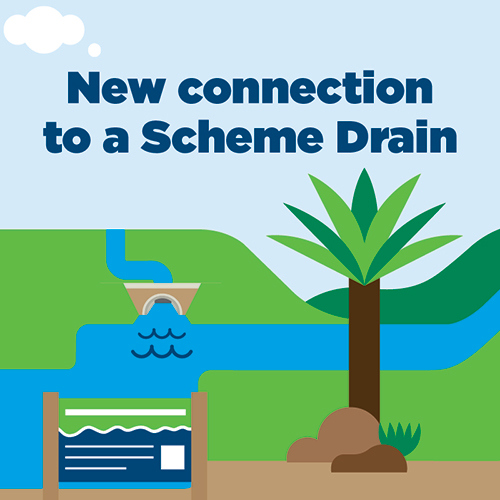
New connection to a Regional Council Scheme Drain – please provide:
- Drain location
- Proposed depth
- Will the drain be open to the scheme drain or will it include a culvert?
- If it’s a culvert please specify the material being used, its diameter, length and supporting calculations.
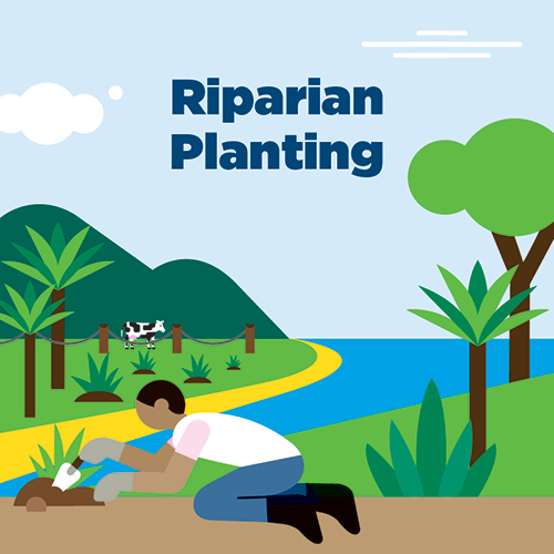
Riparian Planting – please provide:
- Plants you are planning to use
- Plant layout in relation to the drain edge
- Types of fencing you're planning to build and it's distance from the drain edge (if applicable)
What to plant and where?
When deciding what to plant and how wide the riparian margin should be, you need to consider the orientation of the waterway. One of the benefits of riparian planting is that it provides shade to a drain, reducing water temperature and excessive plant growth. Rivers need at least 70% shade for these benefits to be achieved.
Planting zones
Within riparian margins, there are three planting zones where different types of plants should be planted. Planting the upper and lower banks with vegetation improves conditions in waterways for animals that live in there as well as improve terrestrial biodiversity. Leaving rank grass near laneways, bridges, culverts and in swales, where excess rainfall runs off paddocks, will help filter out sediment and phosphorus.
Your local Land Management Officer (LMO) can provide you with support and advice around riparian planting.

Inground swimming pool – please provide:
- Location of pool
- Geotechnical assessment - including seepage analysis and assessment of any risk to a stopbanks integrity
- Pool specifications - dimensions, material, installation methodology, drainage and cleaning outlets
- Details about decking foundations (size of posts, depth in ground, backfill methodology)
- Information on any in-ground connection services e.g. power, water
- We'll need to understand the location, depth, how the services are being installed
- Details on associated activities that require earthworks or digging into the ground e.g. areas of hard surface (e.g. pathways, paved areas), fencing (removal of existing and constructing new), landscaping and plantings, pool sheds etc.
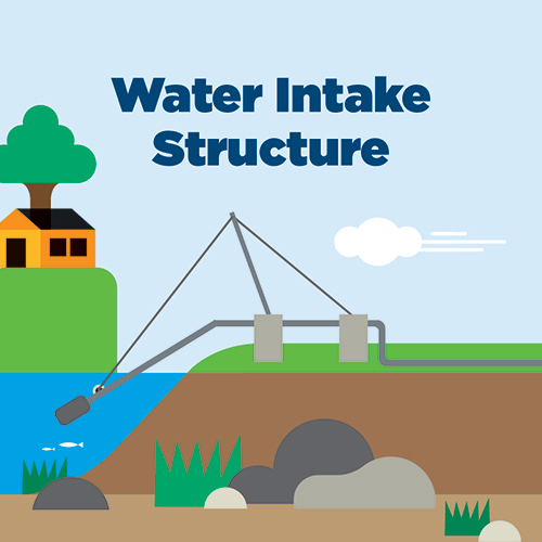
Water intake structures – please provide:
- Location of intake structure and any associated services, pump sheds or foundations
- Design of intake structure and how it is attached to the riverbank
- Outline of associated cabling details (method, depth and proposed backfill) beyond the structure to the destination
- Outline of how the structure will be managed during a flood event.
Other activities that may need a Bylaw Authority may include:
- Subdividing a property
- Planting/removing trees or shrubs
- Constructing/removing a retaining wall
- Dairy effluent system upgrades
- Landscaping involving earthworks.
Frequently asked questions
These Bylaws cover flood defences, drains and canals, and erosion protection managed by, or under the control of, Bay of Plenty Regional Council.
They do not apply to any privately owned or managed drainage or flood protection systems, or those that are managed by other councils.
Do the Bylaws apply to my property?
Depending on where you live in the region the areas covered by the Bylaws may differ. You can find out if your property is covered by the Bylaws using our interactive map.
If the Bylaws apply to my property, what does it mean for me?
The Bylaws aren’t in place to stop people from doing any work on their land, but instead allow us to work with you to ensure any work carried out doesn’t inadvertently affect the integrity of – which help keep us all safe in major floods. This is achieved through a Bylaw Authority, get in touch with us through our enquiry form and we can provide advice and help you through the process.
Does it cost to apply for a Bylaw Authority?
The is no fee for a standard applications although additional charges may apply for technical review or advice.
What happens if property owners don’t follow the Bylaws?
The Flood Protection and Drainage Bylaws 2020 include details on compliance and enforcement.
Check out Section 13 on page 18.
Are other councils involved with the Bylaws?
The Bylaws relate to Bay of Plenty Regional Council managed assets. Your local council also manages assets such as stormwater, so it’s worth checking with them to see if they have specific rules.
Why were these Bylaws updated and how will I know if there will be changes to these Bylaws?
The Local Government Act 2002 requires bylaws to be reviewed every ten years. This ensures the rules are still fit for purpose, informed by the latest science and data and, informed by experience from previous floods. The Flood Protection and Drainage Bylaws were last reviewed in 2020 and became operative on 1 February 2021. The next ten year review is due 2030.
Did the Regional Council consult with the community during the review process?
Regional Council undertook a comprehensive engagement and consultation process with the affected communities for the review of the Floodway and Drainage Bylaws 2008. In developing the new Flood Protection and Drainage Bylaws 2020, Regional Council held focused workshops, community open days, information sessions, hui with iwi and hapū; and a formal consultation process under the Local Government Act 2002.
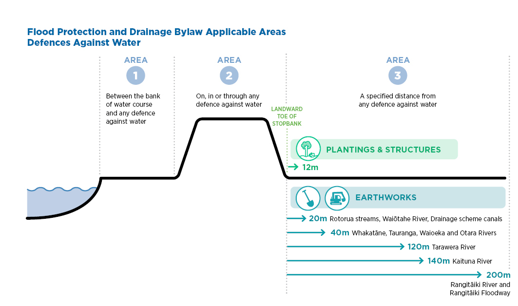
Why are the distances for earthwork requirements different?
There are many soil types across the Bay of Plenty and each has a different resistance to water.
When river levels rise against a flood defence (e.g. a stopbank), water tries to find an escape route by following a path of least resistance. In areas where soil types allow water to travel easily, such as the more porous soils of the Rangitāiki River catchment, a bigger distance is needed between activities done on the land and the defence against water.
If earthworks are done too close to a defence, they can make it easier for water to find places to escape, which can potentially cause it to fail.
If you still have a question that needs answering please send us an email.