
Land
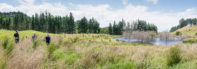
Our land is a non-renewable resource, therefore we need to protect it and use it wisely. Bay of Plenty Regional Council works with landowners to manage and protect the region's soils, water and wildlife.
Natural resources of land in the Bay of Plenty contribute significantly to our economic, social, cultural and environmental wellbeing. They underpin our important agricultural and horticultural industries and provide for recreation, tourism, biodiversity conservation and regional identity.
We need to understand our land to use it in a sustainable manner.

Contact details for the land management officers in your catchment areas for Western Bay of Plenty, Eastern Bay of Plenty and Rotorua.

Exotic forestry makes up about 16 percent of the land in our region. Most of this forestry is in large tracts like the Kāingaroa Plateau, but there are also many smaller woodlots and farm forestry blocks around the region.

The Bay of Plenty still has about 66 percent of its original indigenous forest and scrub cover, but other ecosystem types do not fare as well.

Bay of Plenty Regional Council works with landowners to manage and protect the region's soils, water and wildlife.

River erosion and management guidelines
Intense rainfall can quickly flood rivers, bringing down trees, causing erosion and other damage.
Land-use impacts on waterways


Community case studies
Watch these videos to see how landowners and community groups are taking steps to protect and restore their land and waterways.


Bay of Plenty land use
The land sweeps from Pōtikirua in the east to Waihī Beach in the west. Inland the region is mostly bounded by the watersheds of the river catchments, which flow into the Bay of Plenty and includes the Rotorua Lakes. There are 12,247 square kilometres of land in the Bay of Plenty region, with the following land cover:
- Indigenous forest - 47.3%
- Exotic pasture - 23.8%
- Production forests - 20.1%
- Mixed scrub - 4.1%
- Water - 1.8%
- Horticulture - 1.0%
- Urban areas - 0.8%
- Bare ground - 0.5%
- Coastal sand - 0.2%
- Coastal wetlands - 0.2%
- Urban open space - 0.1%
- Inland wetlands - 0.1%
- Cropping lands - 0.1%
While landowners are responsible for land management on their property, Bay of Plenty Regional Council has statutory functions under the Resource Management Act that include controlling the effects of land use on soil conservation and water quality.
Council staff advise landowners and communities on sustainable land management, biodiversity protection and pest animal and pest plant control. We also carry out research and monitoring and collect information that can be used to inform good decision-making.