Happy new year and welcome to 2024. We hope you’re having a great summer so far and enjoyed what the festive season had to offer.
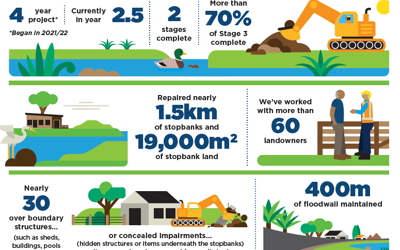
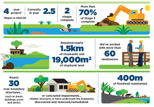
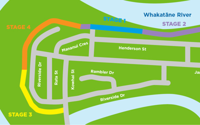
It’s been a busy year already as works on Stage 3 began w/c 8 January and, thanks to good weather days, have been making good progress – read more about this below.
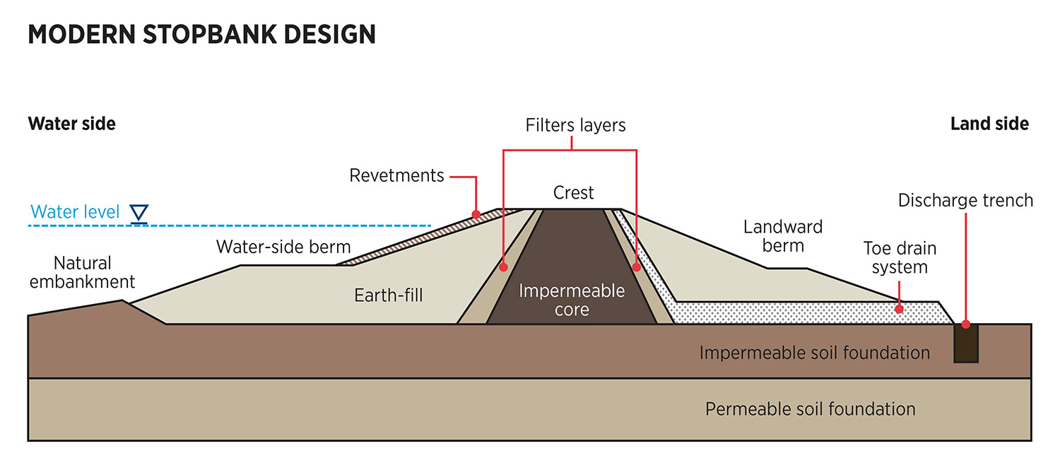
Our engineering team will soon be starting works in the CBD with Project Future Proof. This is a large-scale project to replace and upgrade the stopbanks and floodwalls in town to meet the needs of a changing climate.
Throughout SOS project, our team are always contactable. If you have any feedback, queries or concerns, please contact us on riversanddrains@boprc.govt.nz
The Safeguarding our Stopbanks project team
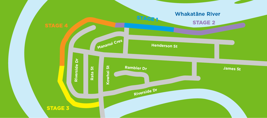
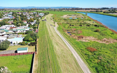
PROJECT UPDATE
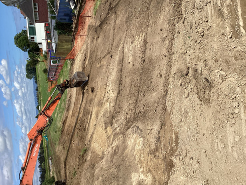
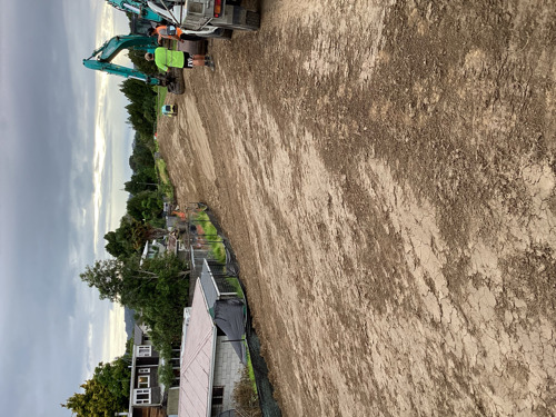
Stage 3
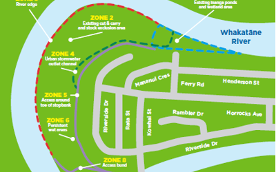
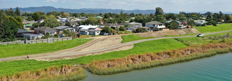
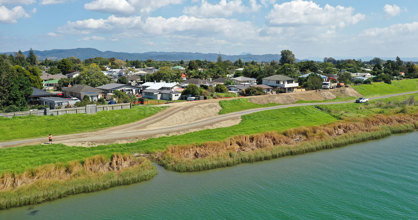
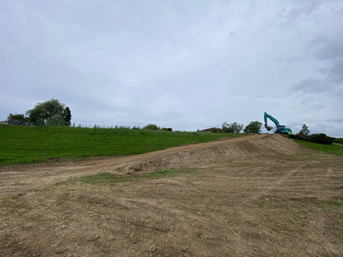
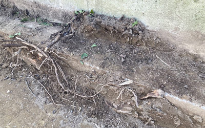
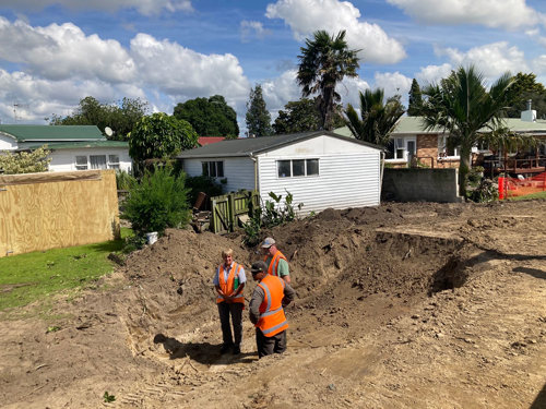
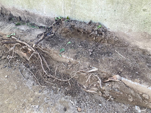
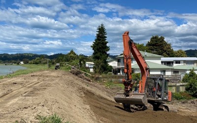
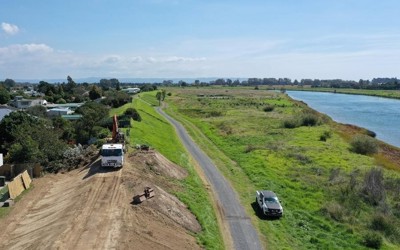
Good weather and ground conditions have aided contractors to make steady progress on the stopbank works in the first section of Stage 3 (some fencing work next to the completed sections has also begun). This section (adjacent to 75 - 91 Riverside Drive) is expected to be complete by early February. The second section of stopbank (adjacent to 93 - 113 Riverside Drive) will follow.
These works include removing all tree stumps, tree roots, inground structures and stopbank repairs, and are on track for completion by the end of April (if weather and ground conditions remain stable). Some tidy up, reseeding and fencing work may carry through to May.
A reminder that this area is an active work site; please be mindful of this and avoid the area at all times for the safety of both you and the contractors. We acknowledge residents may experience some disruption while construction is happening (weekdays from 7.30am to 6.30pm), including noise and possible dust (dust mitigations will be in place).
We have also been notified that several wasp nests have been uncovered during the works. Please contact us if you have any concerns about nests near your property.
We thank you for your patience and understanding.
Thefts in the area
Before works paused for the festive season, our contractor notified us that some fuel and gear were stolen. This occurred at night with the offenders cutting the chain on a gate to gain access and specifically targeting contractor equipment.
While every precaution is taken by our team and the contractors to make sure the site is left in a way that deters criminal activity (for example, loose tools and valuable items are removed from the area) it is not viable for machinery to be moved off site each day. The contractor has put steps in place to reduce the likelihood of future thefts.
Thefts like this are extremely unfortunate for the community and contractors. If you hear or see anything of concern in the area, please contact Whakatāne Police as they are aware of the recent thefts and are monitoring the situation.
Next Reference Group Meeting
The SOS Community Reference Group provides a platform for residents to connect with Council’s project team, have input on how we communicate to residents in the project area, and provide feedback on the process or project to us directly.
Our next meeting is being held at the end of February. If you’d like to learn about the reference group or get involved please contact Kirsty Brown, Rivers and Drainage Asset Manager, via email on riversanddrains@boprc.govt.nz
WHAT’S ON NEAR YOU?
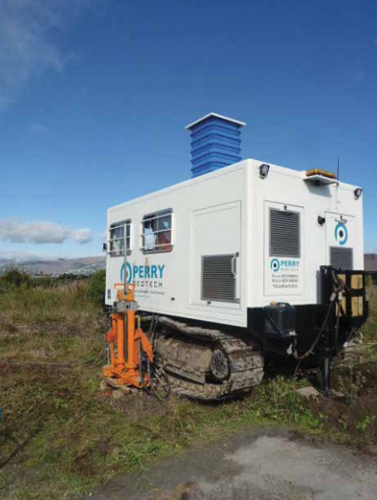
Works notice: Surveying around Awatapu Outlet
We have contractors doing surveying work and ground investigations around the Awatapu Outlet in the coming months. This survey work is not related to SOS, but it is part of our ongoing work to improve flood protection around the rohe. This survey will help inform our review of the stopbanks on the southern side of Whakatāne.
Draft management plan for the river berms
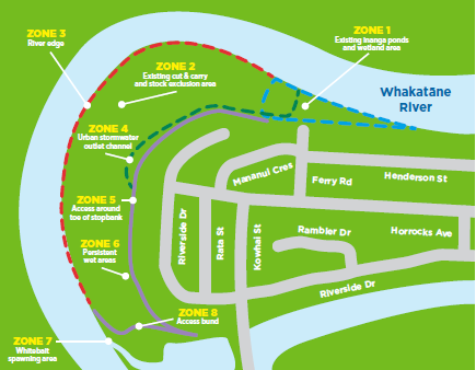
While the SOS project focuses on the flood defences, it has also presented an opportunity to think about environmental enhancement improvements in the adjacent Whakatāne river berm, to make this a thriving habitat and a more user-friendly space.
We have already undertaken work like this in past years, for example when we created the Ferry Road inanga ponds, we not only created a new inanga spawning site, but we also used some of the soil removed from the site to top-up the nearby stopbanks as part of SOS.
We’re now looking at what other improvements could be made to the area – including adjusting the steepness of riverbanks to allow spawning sites and habitat for native fish; enhancing persistent wet areas and introducing native vegetation planting.
This draft management plan is in its infancy, and while this is an early ‘head’s up’, we’re planning to have further discussions with residents about what the area could look like.
If you’re interested to know more, keep an eye out for future communications on this, including a future on-site opportunity for you to provide feedback.
OTHER COUNCIL NEWS
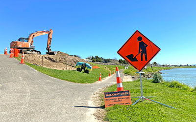
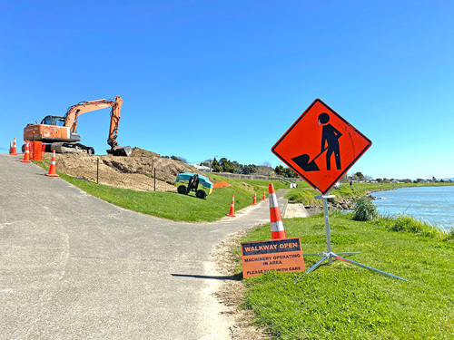
Project Future Proof: Works to start in February
This summer, Regional Council is starting a multi-stage, multi-year project to upgrade the stopbanks and floodwalls in the Whakatāne CBD. This is called Project Future Proof. We’ll be starting along the Warren Cole Walkway between the skate park and the iSite, and working our way downstream over the coming years.
While we’re improving the flood defences, we will also improve pedestrian and accessibility access onto the Warren Cole Walkway from the shopping area across the road, as well as vehicle access into the Yacht Club car park.
During construction, parts of the walkway will require detours and Kakahoroa Drive will be reduced to a single lane around the work site. This will be signposted.
Flooding is the most common natural hazard in Aotearoa, and one of our core roles is to help minimise the risk this poses to people, property and livelihoods. You can keep updated about the project via our website: www.boprc.govt.nz/future-proof
Reminder: Help keep bikes and quads off stopbanks
Whakatāne District Council bylaws prohibit the riding of motorbikes and quad bikes on park and reserve areas, as they can cause damage and be dangerous to other users.
Whakatāne District Council and Whakatāne Police are aware of an increase in activity around Riverside Drive and across the river. To help reduce this behaviour, your assistance is required. If you see vehicles in the area, please immediately report and provide details to Whakatāne District Council on 07 306 0500 or via email info@whakatane.govt.nz
If you suspect that the vehicles are being dangerous, and pose a risk to people or property, please call Whakatāne Police by dialling 105.
Cut and carry: Contractor notifications
Previously, our cut and carry contractors have been putting notices in residents’ letterboxes to let them know when the work is due to happen. However, this hasn’t always worked well as the contractor’s schedule can change (largely due to wet weather).
To ensure communications are more timely and efficient, we have moved to an email and text notification system for those neighbours who would like notification of pending cut and carry operations. The email and text notifications replace the letter drop notices.
Residents who would like to receive the notification, please email riversanddrains@boprc.govt.nz, and give us your email address and cellphone number.