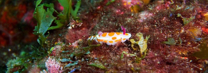
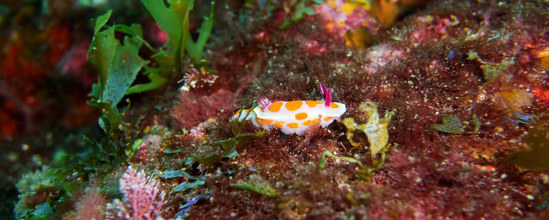
- You can no longer take marine life from the three areas making up the Motiti Protection Area.
- You can anchor in the area so long as you follow the guidelines which are specified below.
- The rules apply to everyone equally, including customary, recreational and commercial fishers, divers, those spearfishing, even if you’re catch and releasing.
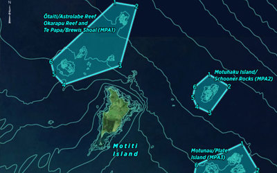
- The rules have been introduced to protect indigenous biodiversity and acknowledge the significant marine, landscape and cultural values in the area. Those three areas comprise of Ōtaiti (Astrolabe Reef); including Te Papa (Brewis Shoal), Te Porotiti, and Okarapu Reef, Motuhaku Island (Schooner Rocks) and Motunau Island (Plate Island).
Motiti Protection Area
You can no longer take marine life from the three areas making up the Motiti Protection Area.
Since the Environment Court directed Regional Council to better protect the three offshore reef systems surrounding Motiti Island, we have been on a mission to better understand the biodiversity and cultural values of these reefs. We have been working with tangata whenua, Department of Conservation and the University of Waikato to monitor the reefs looking at the habitats, biodiversity and taonga species that call these rocky outcrops home.
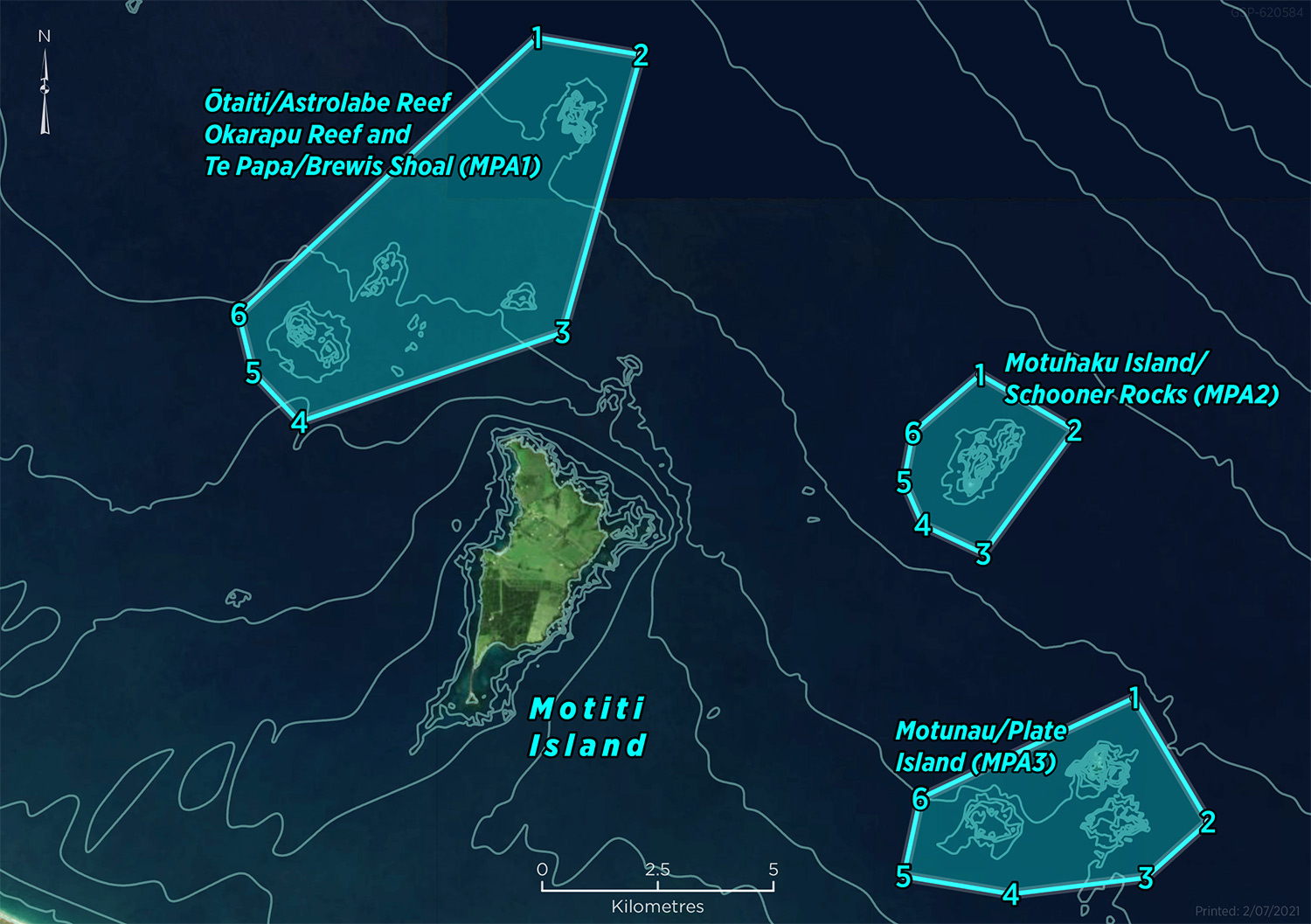
The three areas making up the Motiti Protection Area.
You can see our monitoring programme in action in the video below or learn about it in more detail under the ‘Monitoring’ tab.
You can anchor on the reefs so long as you follow the safe guidelines which aim to help prevent damage to the reefs.
- Use moorings where available (note that there is a mooring buoy at astrolabe).
- When you are anchoring, only do so at 15-20m depth; this will ensure that you minimise the risk of damaging sensitive biodiversity.
- Only anchor in calm conditions ( <10knots wind, <1m swell). If you’re at Motunau, choose a location that is sheltered from the wind and swell on the day.
- Choose the right anchoring kit for your location and vessel – for the Motiti reefs this means a grapnel anchor (best for rock), with the right weight and chain for your vessel.
- Please register your trips; this will allow us to have a good understanding of how many people are out there enjoying the dive sites, and allow us to monitor the reefs to ensure that anchoring is not resulting in any damage to the reef biodiversity.
- Once you’re in the water enjoying the wonderful marine ecosystems, remember to maintain buoyancy, and avoid interfering with any flora or fauna.
The Regional Council are monitoring the three areas that make up the Motiti Protection Area as well as the wider Motiti Natural Environment Management Area. The objective of this monitoring is to determine if the protections put in place by the court are achieving the desired biodiversity outcomes. Are the Marine Protection Areas working?
The BOPRC Science Plan sets down priority work areas, including Toitū te Takutai moana – Marine and Coastal, which includes a number of priority areas in relation to the Motiti Protection Area:
- Develop cultural health indicators (in conjunction with tangata whenua specialist advisory group) to assist with and work with tangata whenua on effective implementation.
- Understanding present and future threats to coastal ecosystems and biodiversity values with a strong focus on climate change, and development of management options.
- Understanding and monitoring ecosystem and biodiversity values in the marine coastal zone to assess potential adverse impacts by fishing activities.
The science plan also identifies resourcing, capability and relationships as requirements to deliver this work. It sets out the importance of working with research providers, local iwi and to include external specialist expertise when needed for areas such as broadscale habitat mapping.
During the Environment Court hearings (see final decision here) a wide range of scientific and cultural knowledge was shared with the courts showing the decline of environmental and cultural health in the Motiti area. Traditional mātauranga Māori knowledge held by tangata whenua represents a longer timeframe of changes observed in the marine environment, compared to the current day state that our monitoring will provide. Additional monitoring based on mātauranga Māori will be co-developed with tangata whenua. We are also investigating ways for recreational divers to monitor and collect their own information to support the wider monitoring programme.
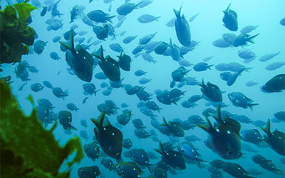
Some of the questions that we will be asking with our monitoring will include: changes in the various habitat types and extents represented in the protection areas (e.g. kelp forest, sponge gardens, kina barrens) and quantitative data on the biodiversity that the reefs and habitats support (e.g. fish species). Continued monitoring using the same methods over time will allow us to measure changes that may occur because of the protections. For example, the changes in fish numbers or the biodiversity associated with kelp forests. Ultimately, this will tell us if the Motiti Protection Areas are protecting and enhancing biodiversity.
Current monitoring programme
There are three main components to the monitoring programme, which include baited remote video surveys, diver habitat and species surveys, and deep reef surveys with remote operated vehicles (ROV). Additional research work in the Motiti Protection Areas is also being conducted by the University of Waikato.
Baited underwater video
Baited underwater video involves dropping a baited frame and video camera down onto the reef for a set period, to observe fish activity. Baited underwater video is a low impact sampling method which provides information on the number and size estimates of scavenger and carnivorous reef-fish species that often can be difficult to survey using divers. The videos are used to count the fish numbers and species and can also be used for size estimates. This is a standard method used for monitoring marine reserves around New Zealand, ensuring our results are comparable with Department of Conservation marine reserves.
A total of 82 sites are monitored across a number of the reef systems, including Okarapu, Otaiti, Motuhaku, Motunau and Motiti. The monitoring takes place between February – April each summer. This survey is designed to capture the range of habitats within 0 – 40m deep, including shallow mixed algae, kina barrens, kelp forests and sponge gardens.
You can read about the results from the first survey in our report. Future reporting will be conducted after we have gathered a number of years of information to build a picture about trends over time.
We are collaborating with Department of Conservation and Wildlife AI to utilise artificial intelligence and citizen science to help process the videos collected. This will allow members of the public and marine learning institutes to get involved in the monitoring of these special areas. For an example of this or to get involved visit Spyfish Aotearoa.
Scuba Diver Surveys
Scuba diver surveys are being used to monitor the abundance of reef fish, grazing invertebrates (such as sea urchins), and the coverage and health of kelp forests. Monitoring is occurring at Okarapu, Otaiti, Motuhaku and Motiti, with a total of 160 quadrats, 96 fish surveys and 32 video transects being collected each year. Sites were selected to align with historical monitoring locations, and some locations have continuous acoustic monitoring (using sound to monitor biodiversity) run by the University of Waikato. Each reef has two representative monitoring locations, with a shallow (5 -10m) and deep (15 – 20m) site within the location (8 locations, with 2 sites at each location).
Fish monitoring is being undertaken using underwater visual census and video. Random 50m long transect lines are laid out across the seafloor, and all fish observed within a set area of the transect are counted and size estimated and recorded underwater. A permanent record of the transect is also taken using video.
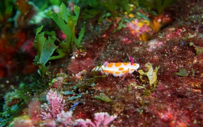
Habitat monitoring is being undertaken using 1m2 quadrats and video surveys. At each site, 10 quadrats are deployed and used to take a representative subsample of the wider monitoring site. In each quadrat the divers are recording: habitat type, urchin number and size (both kina and black long spined sea urchin), kelp number, kelp height and health, cover of other benthic habitat (e.g. sponges, other seaweeds), and number of other invertebrate species (e.g. cooks turban snail, crayfish). Additional surveys are planned to map the size and extent of kina barrens.
Future reporting will be conducted after we have gathered a number of years of information to build a picture about trends over time.
Deep Reef Biodiversity
Deep reefs (>30m depth) are generally outside of recreational scuba diving limits, and therefore to date we have little information about the types of species and habitats that are present on these reefs. A project is underway utilising drop cameras and remote operated vehicles (ROV) to take video footage of a number of deep reefs, ranging from 40 – 80m depth around the Motiti Protection Areas. ROV’s are small underwater robots with a video camera attached, allowing us to collect photos and videos from deep areas outside of the depths that we can safely scuba dive.
The research is a collaboration with DOC and University of Waikato, which aims to increase our understanding of what habitats we have in the area, what species they might support (e.g. special fish, sponges, or rare habitats).
Areas surveyed so far include Nukutai (northern Motiti), Brewis Shoal, and Motuhaku. Early results indicate a very diverse ecosystem including sponges, bryozoans, and soft corals (including black coral).
Completed Research Reports
- 2020 Motiti Natural Environment Management Area – Marine Ecological Literature Review – Boffa Miskell
- 2021 Motiti Natural Environment Management Area – Desktop scoping study of existing bathymetric data – Discovery Marine Limited.
- 2021 Deep reef discoveries: Exploration of deep reef biodiversity in the Bay of Plenty – University of Waikato
- 2022 Baited Underwater Video (BUV) monitoring of the Motiti Protection Areas – BOPRC Environmental Publication
- 2022 Investigation of satellite derived water quality products in the Motiti Protection Areas using NIWA-SCENZ - BOPRC Environmental Publication
- The reef systems off the coast of Motiti Island support a large range of plants and animals including fish and shellfish. In 2018 the Environment Court released an interim decision that found the outstanding attributes and values of these reef systems needed better protection.
- On 24 April 2020, the Environment Court released its final decision which directed Bay of Plenty Regional Council to implement new rules within its Regional Coastal Environment Plan to protect three reef systems near Motiti Island and complete scientific monitoring to inform future integrated marine management solutions.
- The new rules created three protection areas (called the Motiti Protection Areas) around Motiti Island where the taking of all plants and animals (including fish and shellfish) would be prohibited due to their significant marine biodiversity, landscape and cultural values. Those three areas comprise of Ōtaiti (Astrolabe Reef); including Te Papa (Brewis Shoal), Te Porotiti, and O karapu Reef, Motuhaku Island (Schooner Rocks) and Motunau Island (Plate Island).
- View the full Environment Court approved map of the Motiti Protection Area.
Map coordinates for marine GPS or chart plotter
There are a variety of ways to view or download the coordinates for the new Motiti Protection Area.
To manually enter the coordinates into your GPS/chart plotter (latitude and longitude format), refer to the list of GPS waypoints below.
To download the coordinates onto your GPS/chart plotter (.gpx file format), select the GPS waypoints and/or GPS trackline files listed below. For support on how to update your device or card reader please refer to the relevant instructions.
Alternatively, to view an interactive map of the area or if your GPS/chart plotter requires a shapefile or Geojson file type please visit our Bay of Plenty Maps website.
Before entering the coordinates, please ensure your GPS/chart plotter has been set to the following format: DDD°MM.MMM.
Because the Motiti Protection Area is made up of three areas, the best way to capture this data is to create a route for each area. The waypoints are as follows:
ID---- Latitude Longitude
MPA1 1 S37°31.453' E176°24.990'
MPA1 2 S37°31.614' E176°26.523'
MPA1 3 S37°34.887' E176°25.528'
MPA1 4 S37°36.043' E176°21.705'
MPA1 5 S37°35.483' E176°21.003'
MPA1 6 S37°34.809' E176°20.762'
MPA2 1 S37°35.197' E176°31.670'
MPA2 2 S37°35.803' E176°33.084'
MPA2 3 S37°37.287' E176°31.820'
MPA2 4 S37°36.978' E176°30.909'
MPA2 5 S37°36.482' E176°30.608'
MPA2 6 S37°35.904' E176°30.719'
MPA3 1 S37°38.901' E176°34.113'
MPA3 2 S37°40.317' E176°35.266'
MPA3 3 S37°40.999' E176°34.385'
MPA3 4 S37°41.248' E176°32.414'
MPA3 5 S37°41.087' E176°30.824'
MPA3 6 S37°40.170' E176°31.027'
Project updates
A YEAR AGO
One year of the Motiti Protection Area
The Motiti Protection Area, covering the three offshore reef areas surrounding Motiti Island, came into effect one year ago today and initial monitoring programmes are underway.
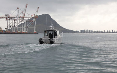
Since 11 August 2021, Bay of Plenty Regional Council has had Compliance and Maritime staff patrolling the area to ensure the rules are being respected, plus exploring a range of scientific and marine monitoring programmes.
2 YEARS AGO
Motiti Protection Area now in place
The Motiti Protection Area is now in place, meaning people can no longer take any kind of marine life from the three offshore reef areas surrounding Motiti Island.
3 YEARS AGO
Motiti Protection Area rules signed off by the Minister of Conservation
The Minister of Conservation has approved the Bay of Plenty Regional Coastal Environment Plan.
3 YEARS AGO
Environment Court approves Motiti Protection Areas
The final decision on the proposed Motiti Protection Areas was released by the Environment Court on Friday afternoon.