Skip to main content Skip to footer
Menu
Lake-Okataina Lake-Okataina

Lakes

Bay of Plenty’s lakes are a treasure of the region, with 18 located in the in Rotorua Lakes area. These lakes are popular for many forms of recreation and are a taonga to the people of Te Arawa.

With a focus on preserving our lakes for present and future generations, we are partners of the Rotorua Te Arawa Lakes Programme alongside Rotorua Lakes Council and the Te Arawa Lakes Trust. Under this programme, we've set up land use change agreements with landowners to reduce contaminants entering the lakes and establish permanent land use change.

We are also implementing engineering solutions, including phosphorous locking treatment, to remove nutrients from Lake Rotorua.

We recognise and provide for Te Mana o te Wai (the intrinsic value of water).

For more information, please visit the Rotorua Te Arawa Lakes Programme website.

Bay of Plenty Regional Council was granted resource consent to build the diversion wall structure in Lake Rotoiti. The diversion wall is designed to stop water flowing from Lake Rotorua into the main body of Lake Rotoiti, instead diverting it down the Kaituna River via the Ōhau Channel.

Most of Lake Rotoiti's problems are caused by nutrients flowing into it from Lake Rotorua, so the diversion wall will, over time, significantly improve the lake's water quality. Scientists say it will have little impact on Kaituna River quality.

The Ōhau Diversion Wall information sheet has information about the wall.

The wall

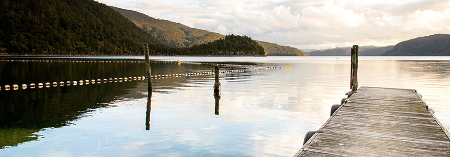
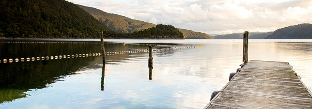
The diversion wall starts just south of the entrance to the Ōhau Channel which links Lake Rotorua and Lake Rotoiti. It runs 75 metres offshore parallel to State Highway 33 and extends to Te Akau Point (1,275 metres). The diversion wall is driven into Rotoiti's lake bed and rises to just above lake level. It is made of large, precast interlinking concrete and steel wall segments designed to last for at least 50 years. There is a cap on top of the wall to discourage people from walking on it, for safety reasons.

The diversion wall cost approximately $10 million to build, funded by Bay of Plenty Regional Council and Central Government.

The final design of the structure was based on feedback from the public at various hui and public meetings, as well as comments received on questionnaires, and a number of technical studies. These studies include:

  • Water quality modelling.
  • Sediment transport modelling.
  • Hydrodynamic modelling of the lake.
  • Geotechnical investigations.
  • Assessment of effects on downstream water quality in the Kaituna River and Maketū Estuary.
  • Landscape and visual assessment.
  • Cultural assessment.
  • Ecological assessment, including effects on fish and water birds.

What the wall achieves

The wall diverts water currently flowing through the channel from Lake Rotorua into Lake Rotoiti, directly down the Kaituna River. Previously, about 40 percent of this water flows into the Kaituna River, mostly in summer. The rest of the year it flowed mostly into Lake Rotoiti.

The diversion wall prevents 180 tonnes of nitrogen and 15 tonnes of phosphorus entering the main body of Lake Rotoiti from Lake Rotorua each year through the Ōhau Channel.

Both the Ōkere Gates and Ōhau Weir are man-made structures to help control water levels in lakes.

The Ōkere Gates were constructed in 1982 to regulate the flow of water from Lake Rotoiti into the Kaituna River. The Ōhau Weir was constructed in 1989 to control water level fluctuations in Lake Rotorua.

Bay of Plenty Regional Council was granted a resource consent for the ongoing operation of the Ōkere Gates and the Ōhau Weir on 26 March 2012 after consultation and negotiation with a number of key stakeholders.

Two kaitiaki groups and the Rotorua Te Arawa Lakes Operational Liaison Group provide a voice for the community. These two groups are supported by Council, to ensure interested community members can have input into the monitoring and management of the Gates and Weir.

If you would like more information about the operation of the Ōkere Gates or Ōhau Weir please phone the engineering team at Bay of Plenty Regional Council on 0800 884 880.

Cultural Management Plan for Ōkere Gates and Ōhau Weir:

Meeting minutes

Lake Rotoiti, meaning ‘the small lake’, is actually a relatively large lake lying to the east of Rotorua. It’s a fantastic spot for fishing and boating, with the stunning Manupirua Hot Springs on its shores (which are only accessible by boat).

Lake Rotoiti is linked to Lake Rotorua via the Ōhau Channel, which means the quality of the water in Lake Rotorua has a significant effect on Lake Rotoiti. In 2008, a 1,300-metre-long wall was constructed to prevent water with a high nutrient content from flowing directly into Lake Rotoiti. As a result, more than 70 percent of the nutrients that were flowing into the lake have now been diverted down the Kaituna River.

This strategy dramatically improved water quality in Lake Rotoiti from its crisis point in the mid-2000s, and it’s thankfully now stable. The Bay of Plenty Regional Council has been hard at work controlling catfish in the lake and will continue to manage the pest ongoing.

The long term plan for Lake Rotoiti is to eventually remove the Ohau Diversion wall to enable the waters to mix again, once the inflow of nutrients to Lake Rotorua has reduced.

Bay of Plenty Regional Council (BOPRC) is the consent holder of two resource consents that authorise activities associated with the operation and maintenance of the Okere Control Gates at the outlet of Lake Rotoiti.

BOPRC is seeking variation to these resource consents.  These changes fall into two groups:

A trial for a period of three years and five months to vary the lake level management regime and also drawing the lake level down to RL278.85m for a period of one week within the trial period. This is close to the lowest level the lake has been recorded at.  This trial is based on a joint proposal by BOPRC and Ngāti Pikiao Environmental Incorporated Society (NPES), and will allow investigation of impacts on Lake Rotoiti identified in the Cultural Management Plan.

At the same time, BOPRC is seeking permanent changes to conditions covering four aspects of the resource consent which are either no longer required or require modification for administrative efficiency.

BOPRC has undertaken considerable consultation on the proposal and has attempted to minimize the impact on any parties by planning the lowering only on one occasion during the 3 year period and programming it during the winter so that once the low level is achieved the lake can be rapidly re-filled. Further detailed information can be found in the Lake Rotoiti Lake Level Control Trial Summary.

Unprecedented rainfall this year has caused flooding and rising lake levels at Rotomā and Rotoehu. This has impacted residents and resulted in flooding of roads and slips around certain areas of both lakes. The situation is being closely monitored and those who require assistance are being put in touch with Rotorua Lakes Council via an Incident Management Team set up to provide a single port of call for support for residents. If you or anyone you know is impacted by this, please refer to their website.

See more information below regarding Lake Rotorua events, closures and health warnings.

rlc ogo   boprc logotalt logomfe logo